Total Eclipse of the sun Monday August 21st, 2017. This page has weather forecast information along the path, to help you plan where the clearest skies might be for this event. This page also features links to information about the Eclipse itself, to help you prepare for viewing.
NOTE: New Forecast Satellite Photo Added this morning
Countdown to start of Eclipse over Jackson, WY
[tminus t=”21-08-2017 10:16:43″ style=”cloud-city” omitweeks=”true” /]
Cloud Forecasts & Eclipse Info
Cloud Cover Forecast maps were updated Monday morning 0600 MDT.
One cloud cover forecast map from computer models is displayed, others can be viewed by clicking “More+“. All maps are valid for Noon Mountain Daylight Time on August 21st. (That is: 1100 PDT, 1200 MDT, 1300 CDT, 1400 EDT) .
Maps Updated 0600 MDT August 21st
Cloud Cover Forecast
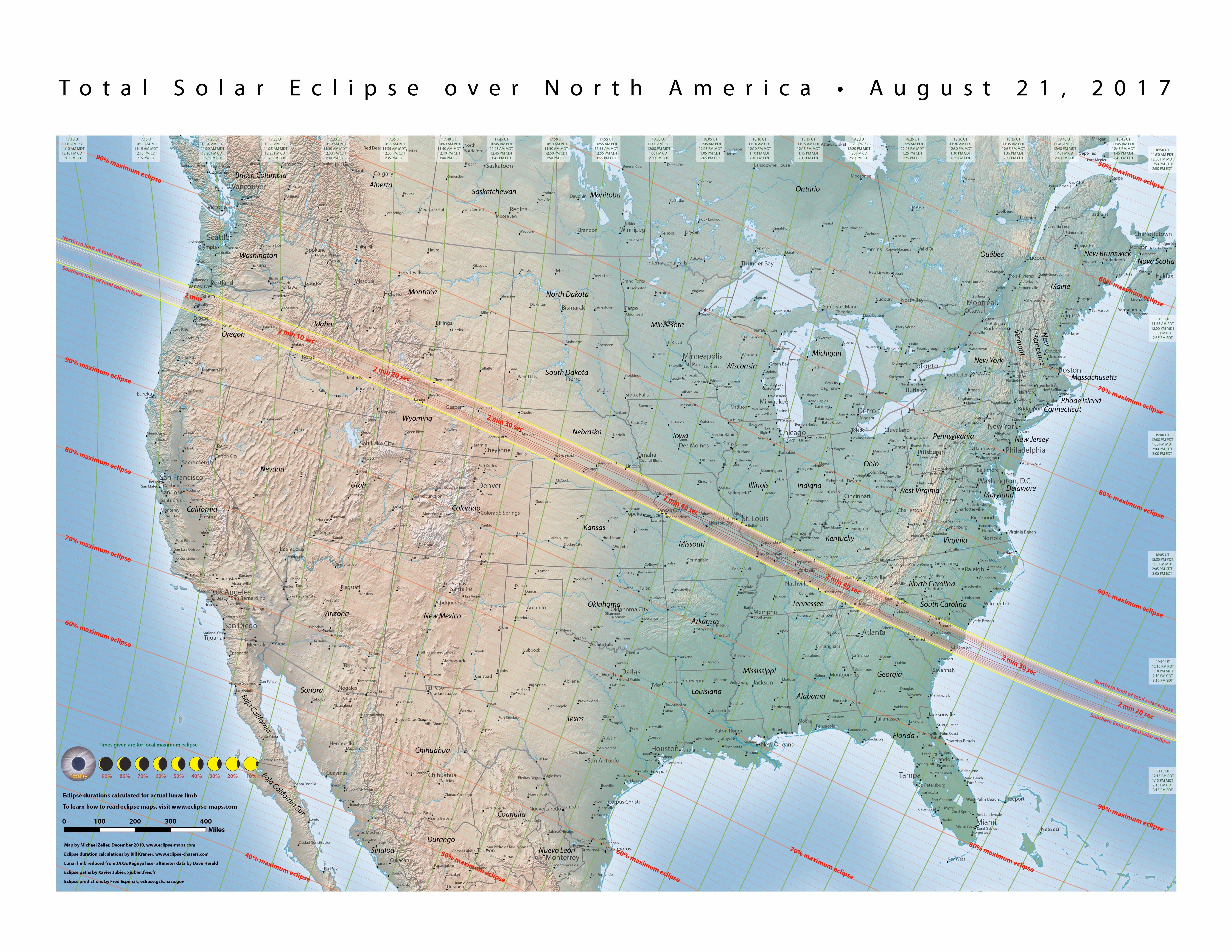
Eclipse Info
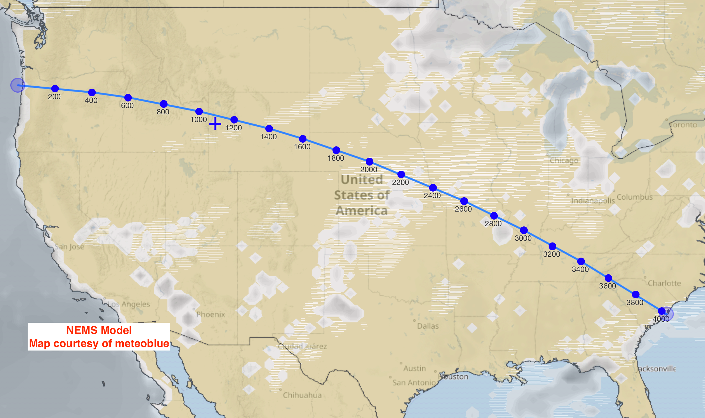
USA Cross-Section
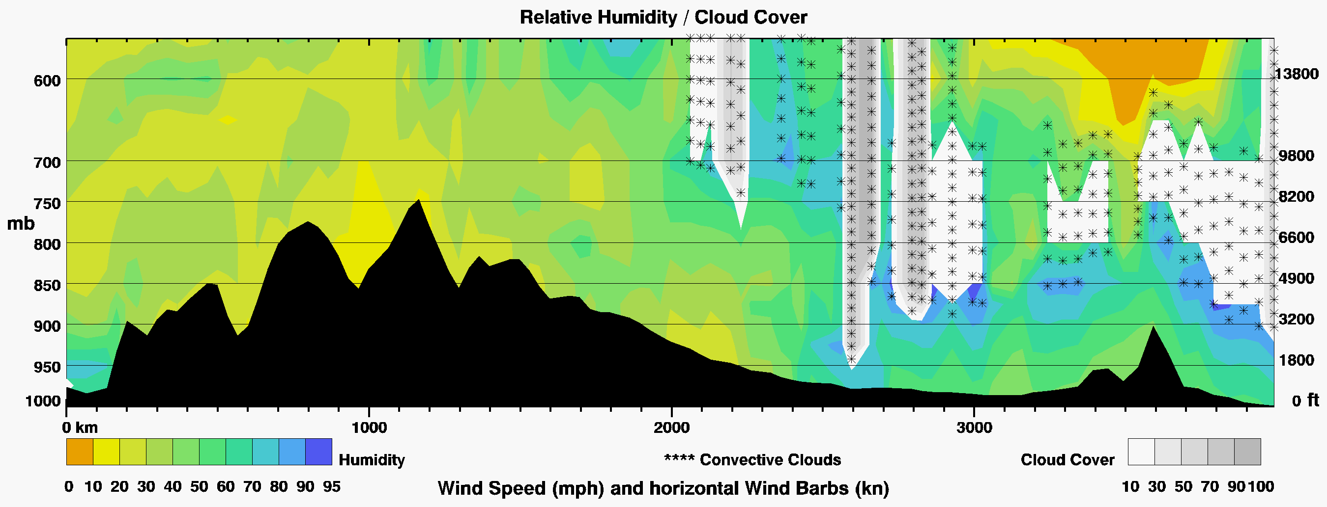
Vertical Cross-Section along the Path of Totality:
A look at RH & clouds above the terrain across the USA,
from the coast of Oregon to the coast of South Carolina.
Only includes clouds below @ 14,000-ft. elevation.
Valid at Noon MDT (1100 PDT, 1200 MDT, 1300 CDT, 1400 EDT)
Monday August 21st, 2017.
Graphic from meteoblue.
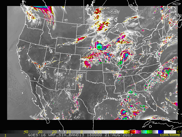
Forecast Satellite Photo
This is a computer generated forecast satellite photo for the USA at Noon MDT on Monday August 21st showing where the clouds should be at that time.
Forecast Satellite
Last Outlook: Monday, August 21st, 2017 E-Day!
Read meteorologist Jim Woodmencey’s latest Eclipse Weather Outlook. Click Here>>
Wyoming Cloud Cover Forecasts
Regional cloud cover forecast maps valid for 12:00 Noon MDT on August 21st are shown below, from three different models, focus is on Wyoming.
NEMS Model
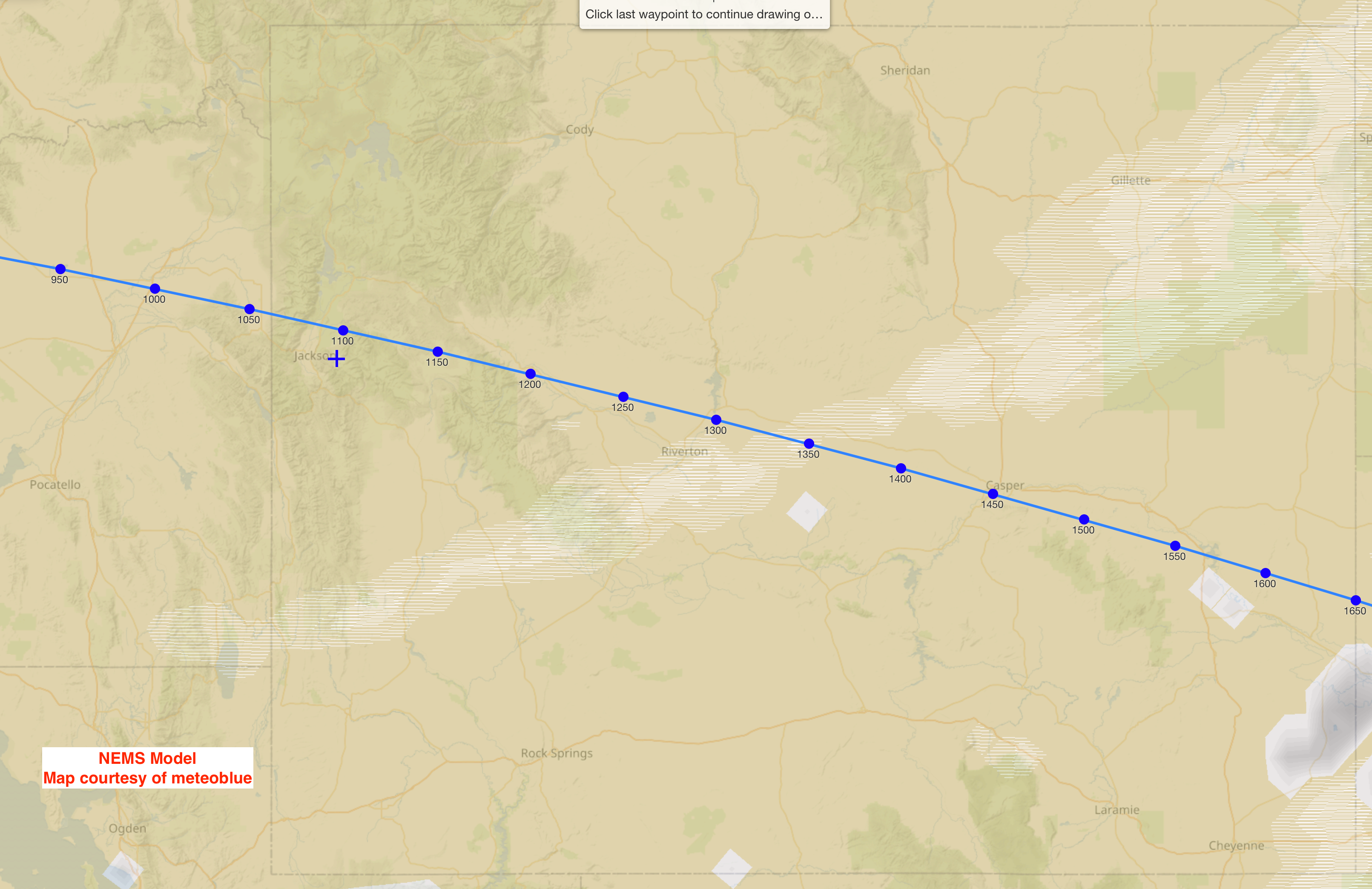
NEMS Model:
NOAA Environmental Modeling System
Scale is from white or light gray representing 10 to 25% sky cover. Up to very dark gray representing near 100% cloud cover.
European Model
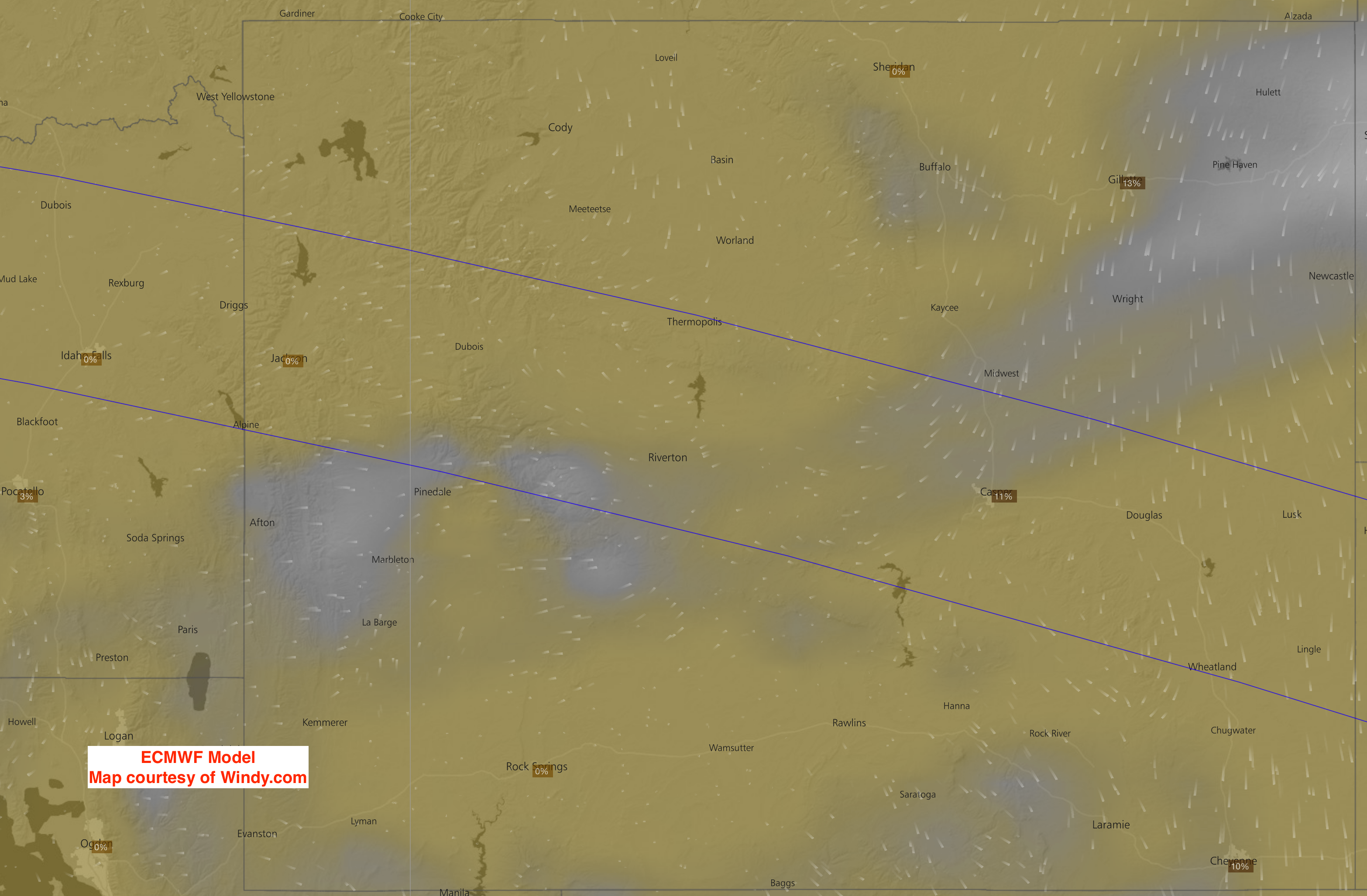
ECMWF Model:
European Center for Medium-range Weather Forecasts
a.ka. The “Euro” Model
Scale is from a dim but darker gray, representing 10 to 30% cloud cover. To a dim but whiter shade, representing something more than 50% cloud cover. To areas where cloud cover is hatched and colorized, representing 80 to 100%, and precipitation is also likely.
GFS Model
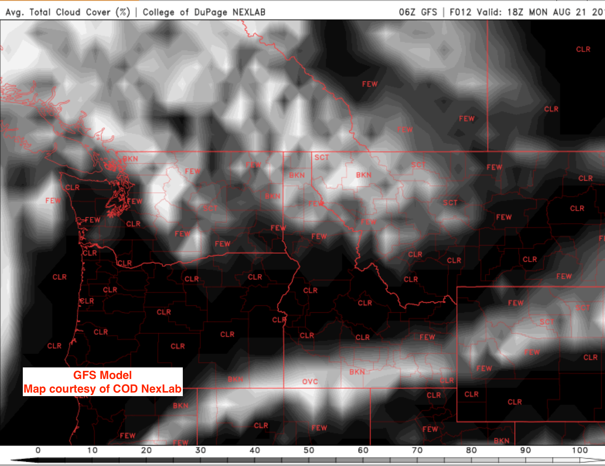
GFS Model:
Global Forecast System
Scale of cloud cover:
CLR = Clear skies
FEW = 10 to 20%
SCT = 30 to 50%
BKN = 60 to 70%
OVC= Overcast or 100%
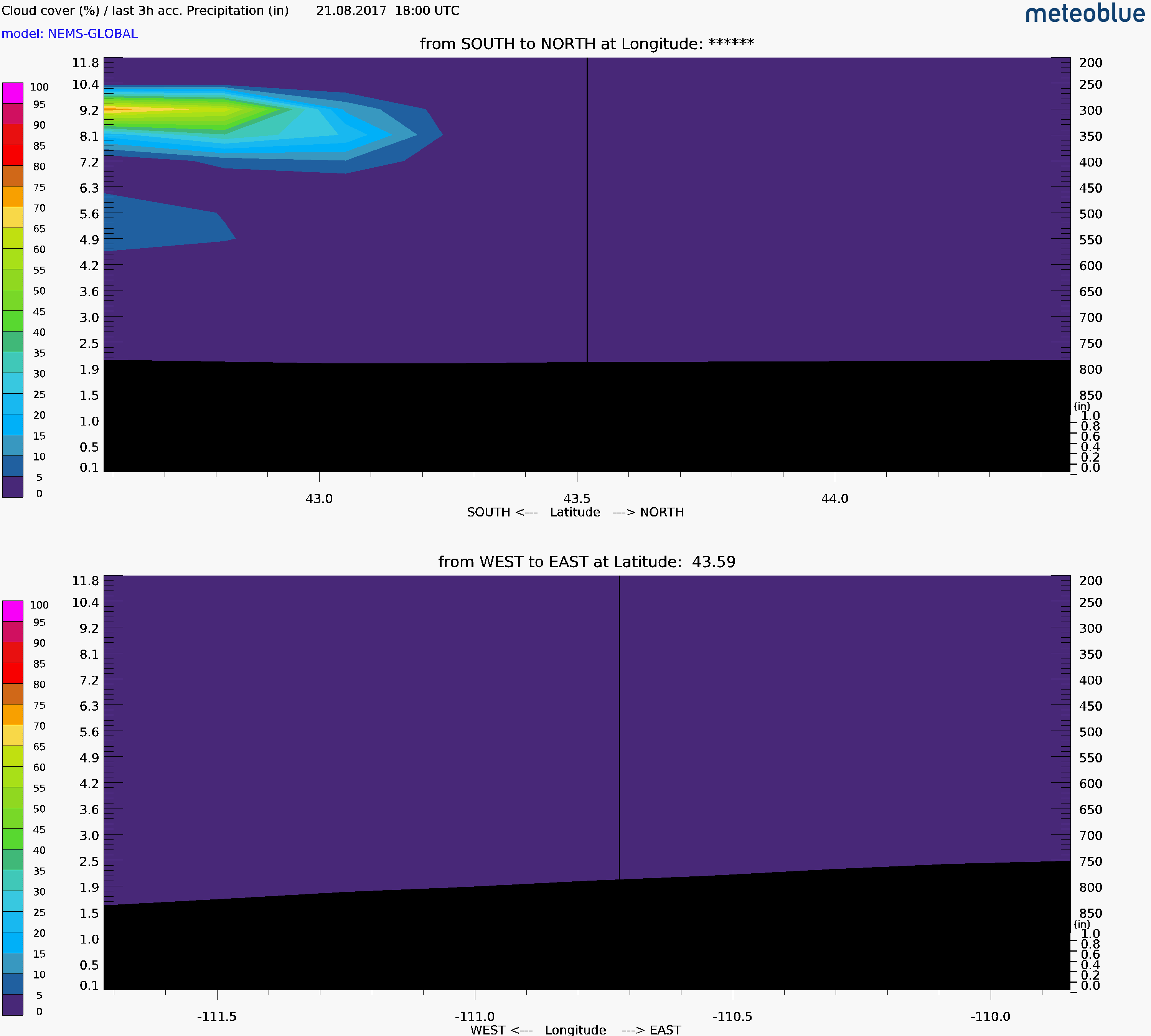
Jackson Hole Cloud Cross-Sections
These cloud cross-sections are centered over Gros-Ventre Jct. near the Jackson Hole Airport, under the center of the max line. They are Valid for 10:00 am, 11:00 a.m. & Noon on Monday August 21st. The scales on the left side show the percent cloud cover (colors) & also the altitude in Kilometers. The South to North panel extends about 50 miles north & 50 miles south. The West to East panel covers about 70 miles West & 70 miles East of the location.
UPDATED: 0600am MDT Monday, August 21st
10 am over Jackson Hole
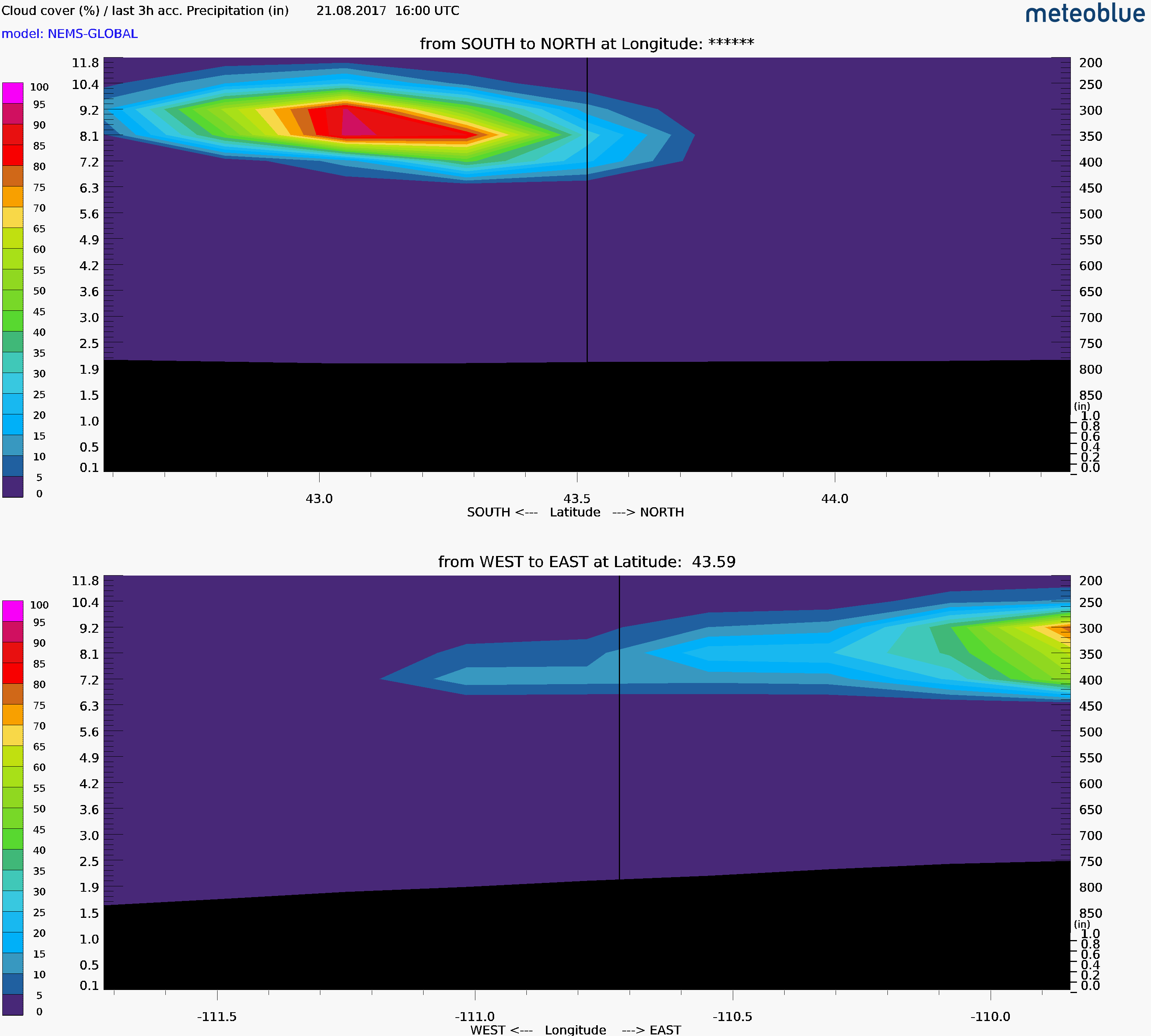
Cross sections generated from the NEMS Model:
Extends vertically to an elevation of @ 35, 000 to 40, 000 ft.
Graphics from meteoblue.
11am over Jackson Hole
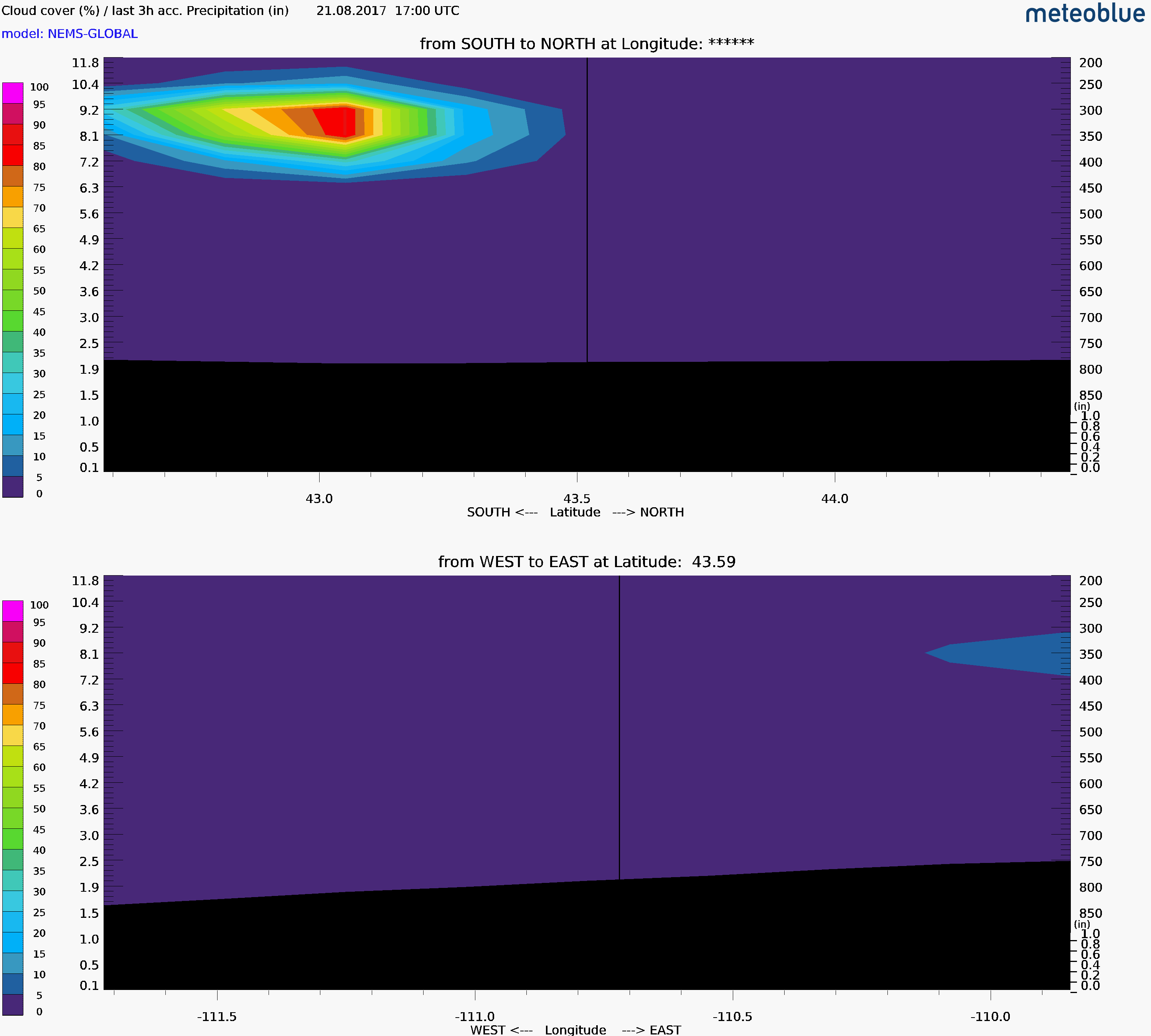
Extends vertically to an elevation of @ 35, 000 to 40, 000 ft.Graphics from meteoblue.
Noon over Jackson Hole
Extends vertically to an elevation of @ 35, 000 to 40, 000 ft.Graphics from meteoblue.
Viewing Times & Data
Start times are for beginning of Partial Eclipse. The Total Eclipse peak time is the point of the Maximum Eclipse. The End Time is when the Partial Eclipse is completely over. All times are local MDT.
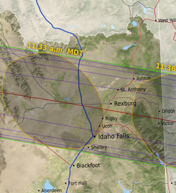
Eastern Idaho
Idaho Falls, ID
Start Time= 10:15 am
Total Eclipse peak= 11:33 am
End Time= 12:57 pm
More Details:
All times MDT
Start of Total= 11:32:34 am
End of Total= 11:34:51 am
Duration of Total= 2min 18sec
Altitude of Sun at Peak= 49° (above the horizon)
Azimuth of Sun at Peak= 132° (Southeastern sky)
Location under center line:
I-15 & HWY 33 at Sage Junction
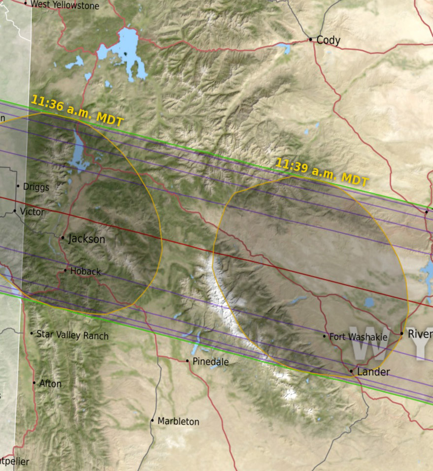
Jackson Hole Area
Jackson, WY
Start Time= 10:16 am
Total Eclipse peak= 11:36 am
End Time= 1:00 pm
More Details:
All times MDT
Start of Total= 11:35:00 am
End of Total= 11:37:20 am
Duration of Total= 2min 20sec
Altitude of Sun at Peak= 50° (above the horizon)
Azimuth of Sun at Peak= 135° (Southeastern sky)
Location under center line:
Gros Ventre Jct.-Kelly Road
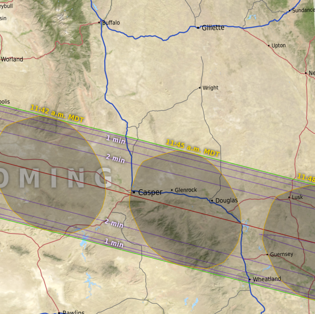
Central Wyoming
Casper, WY
Start Time= 10:22 am
Total Eclipse peak = 11:43 am
End Time= 1:09 pm
More Details:
All times MDT
Start of Total= 11:42:38 am
End of Total= 11:45:04 am
Duration of Total= 2min 26sec
Altitude of Sun at Peak= 54° (above the horizon)
Azimuth of Sun at Peak= 143° (South-SE Sky)
Location under center line:
Casper College
NWS Point Forecasts
Hit “More+” under each region to see links to National Weather Service Point Forecast data for specific locations under the path of totality. These graphical forecasts include Sky-Cover forecasts, the blue line shows the percent of cloud cover predicted overhead, hour-by-hour, for the next 5 to 6-Days.
NOTE: Anywhere within the shaded area on the maps will experience a TOTAL Eclipse. The duration of the eclipse will be longest along the red center-line.
Eastern Idaho
Graphical Point Forecasts:
Pick your own Point Forecast:
Use the IDAHO W.A.M.
Use pre-set location icons,
or move blue magnifying glass
to a specific location.
Western Wyoming
Graphical Point Forecasts:
Pick your own Point Forecast:
Use the WYOMING W.A.M.
Use pre-set location icons,
or move blue magnifying glass
to a specific location.
Central-East Wyoming
Links to Point Forecasts:
Pick your own Point Forecast:
Use the WYOMING W.A.M.
Use pre-set location icons,
or move blue magnifying glass
to a specific location.
Forest Fire Smoke
Map showing location of current active forest fires in USA. Satellite images of smoke plumes in Oregon, and also Idaho/Montana.
USA Current Fires Map
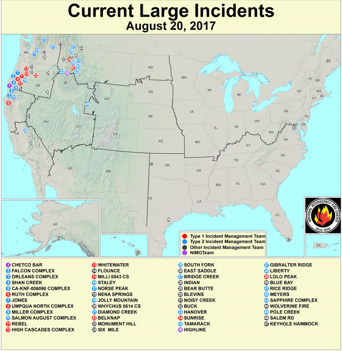
Large Active Fires Map:
Biggest fires are red & blue dots, seen over Western Oregon near Crater Lake and also up in the mountains of far western Montana.
Oregon Smoke
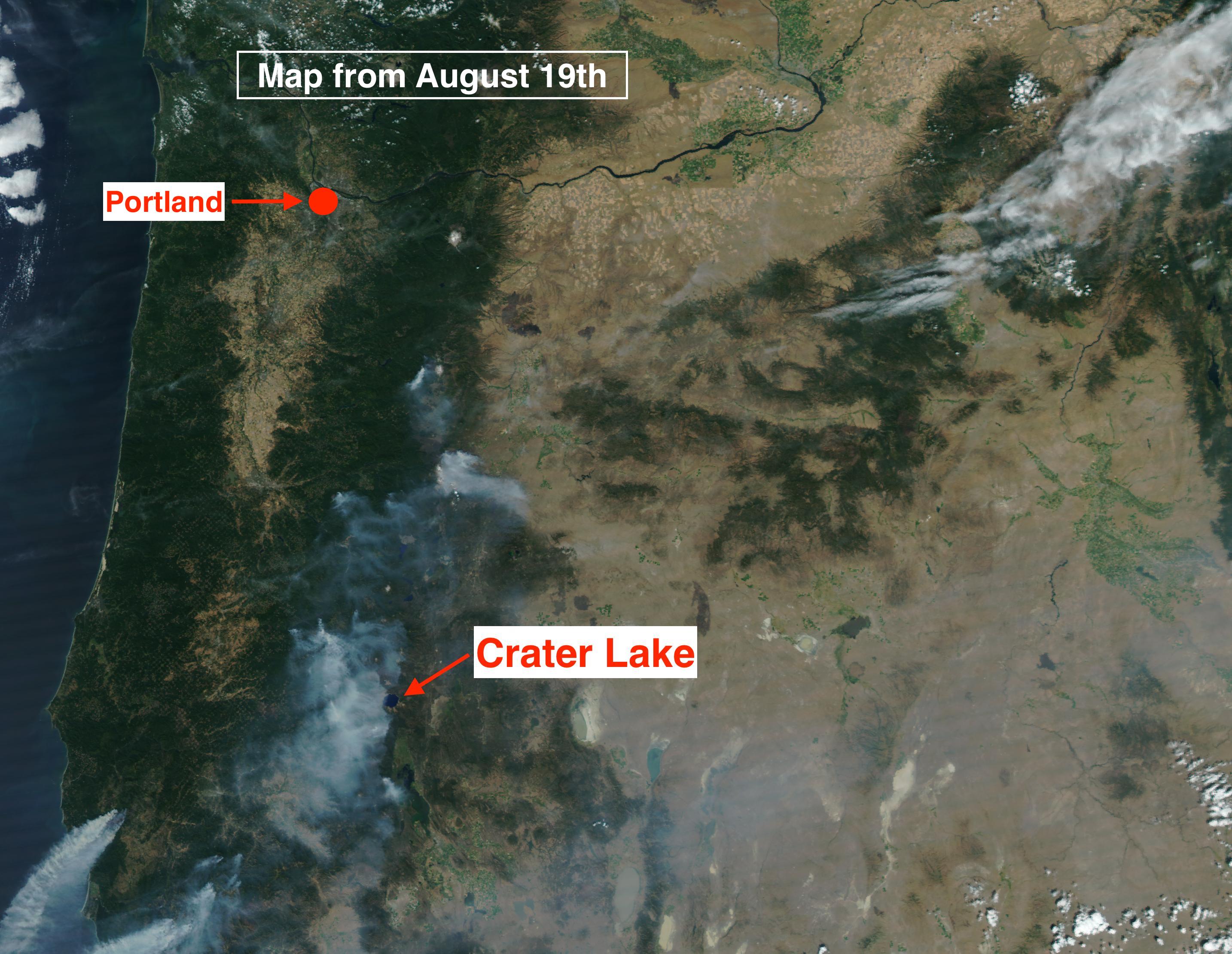
Hi-Res Satellite of Oregon:
Smoke plumes can be seen coming off of the largest fire just west of Crater Lake and that smoke thins out as it spreads across the southern half of Oregon in the upper levels of the atmosphere.
Idaho-Montana Smoke
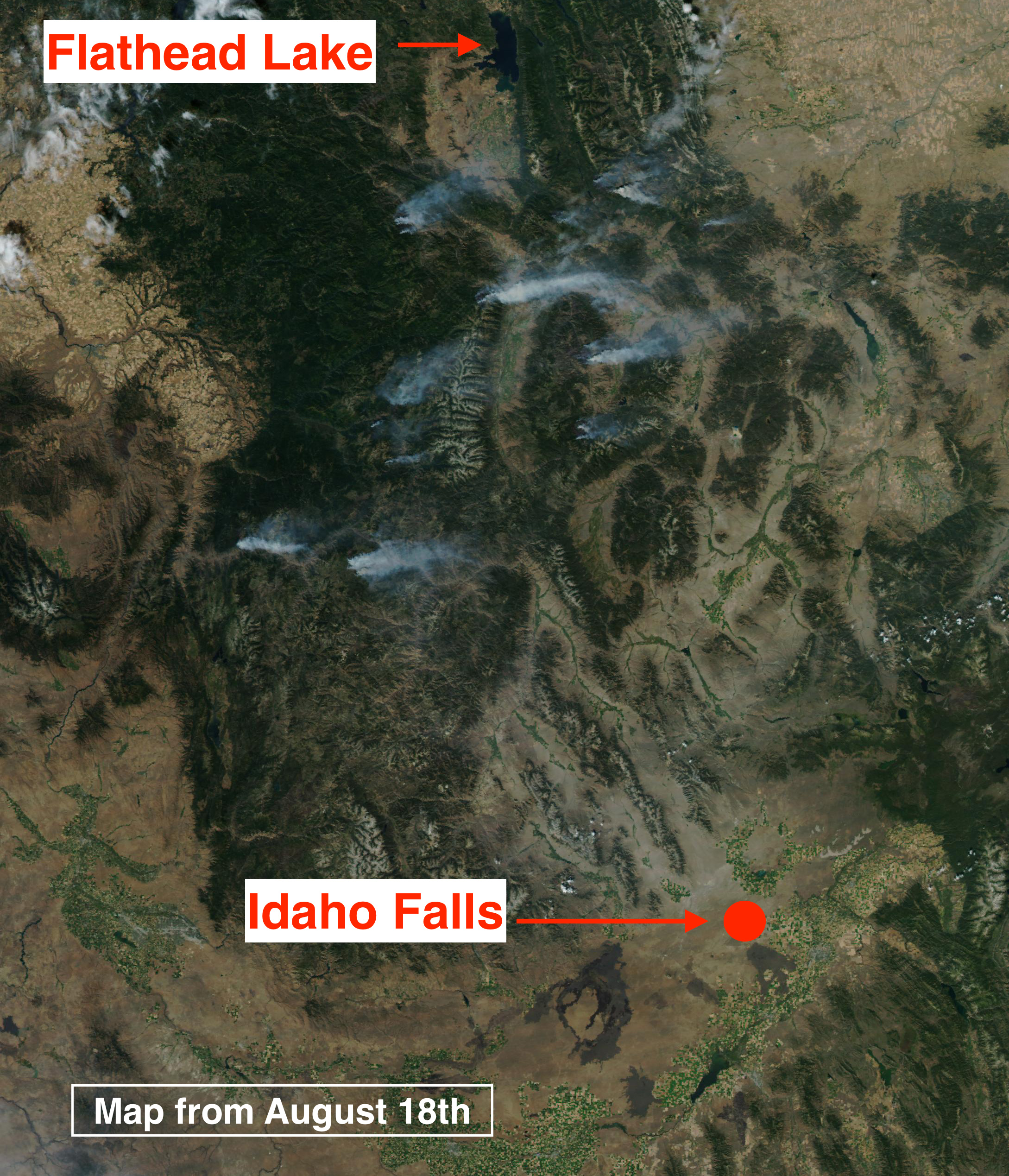
Hi-Res Satellite ID-MT:
Smaller fires burning in north-central Idaho and in western Montana mountains. Smoke is trailing off almost to the due East in a moderately strong Westerly flow aloft.
For a Printable Eclipse Fact Sheet from NASA, Click Here>>
See historic Aug. 21st Satellite images on the MountainWeather Blog. Click Here>>
Where the best viewing weather might be…read Jim’s column from the JH NaG>>
Mike Zeiler’s Animation of the Eclipse shadow crossing the Tetons, Click to View>>