MountainWeather Lite is a selection of the most commonly used weather maps & forecast tools, all on one page. This is the page used in the basic Mountain Weather Forecasting Courses.
Satellite & Radar
GOES-18 West Satellite

GOES-18 Large Views
GOES-18 Regional Views
GOES-19 Regional Views
GOES-19 East Satellite

GOES-19 Large Views
GOES-19 Regional Views
Radar
Radar Mosaics
Other Radar Links
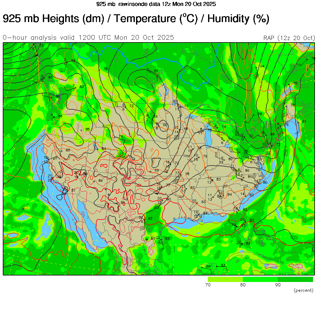
Upper Air Maps
Upper Air Maps
Aviation Maps
Balloon Soundings
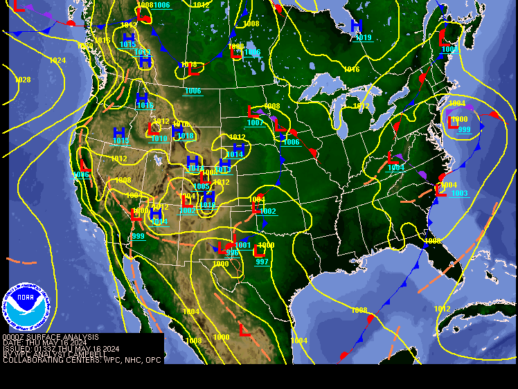
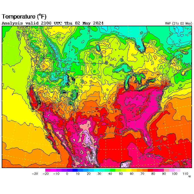
Surface Maps
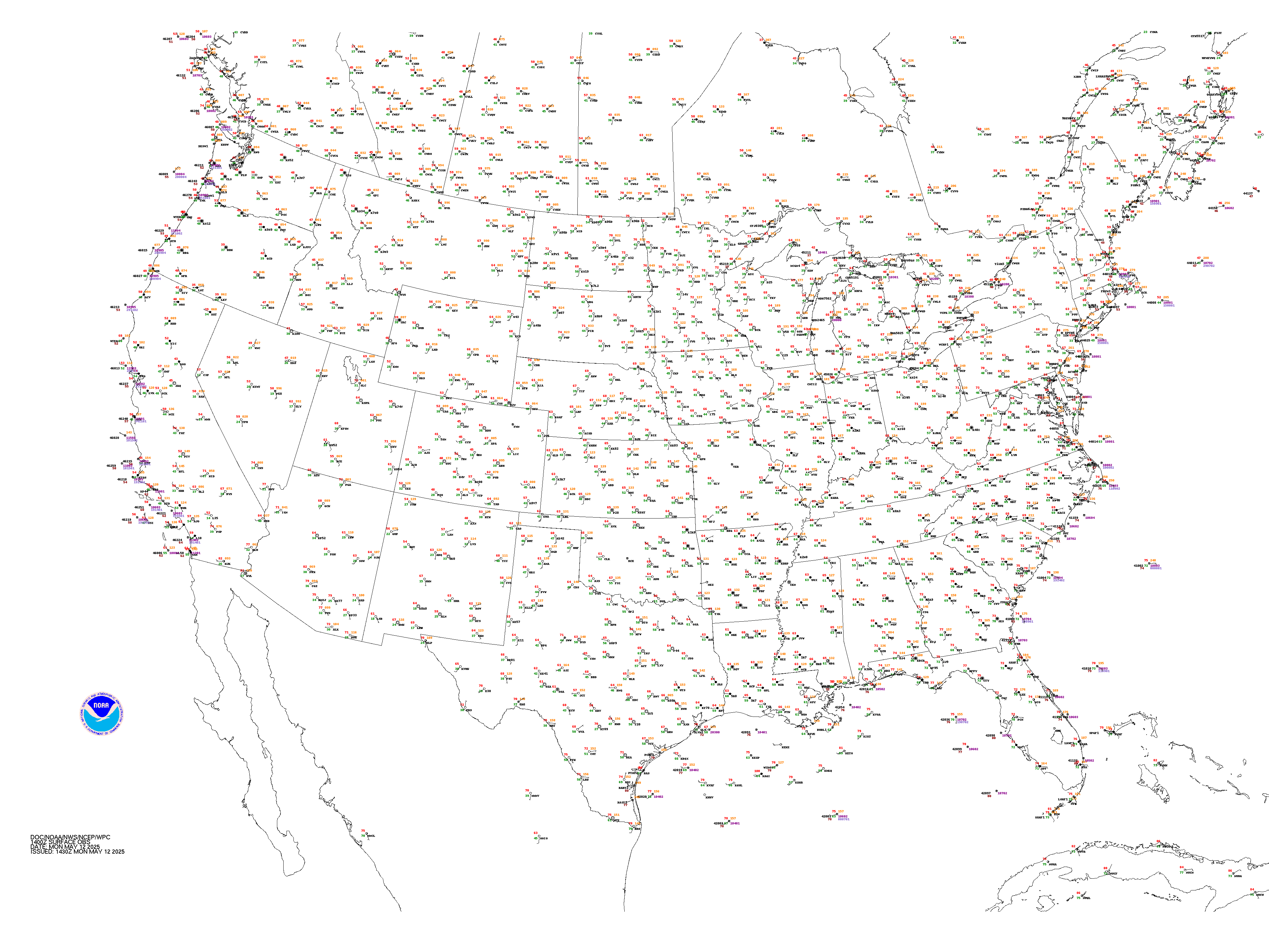
Surface Maps
Regional Obs Maps
Regional Surface Obs
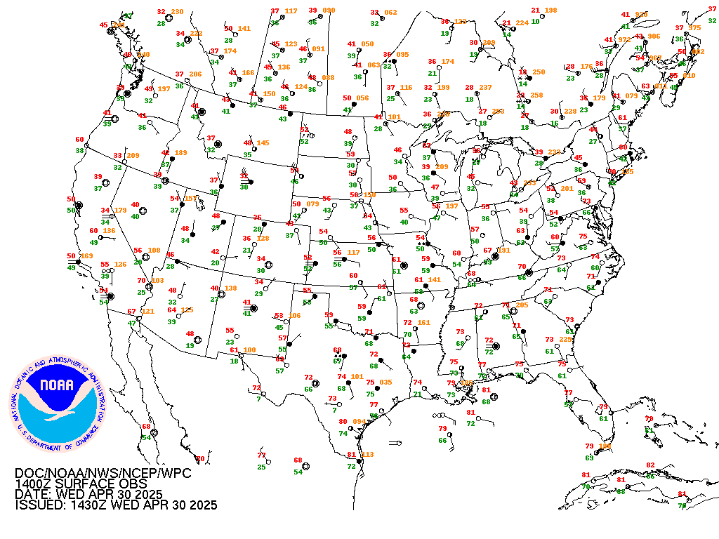
Surface Observations
Regional Maps
Webcams
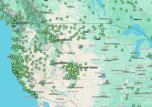
West Coast Cams
Intermountain
Rockies
Map Toolbox
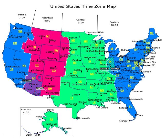
Time Tools
Map Tools
- Basic Meteorology
- Pressure vs. Elevation
- Fronts & Boundaries
- Weather Symbols
- Obs Codes
- Surface Obs Help
- US Airport ID’s
- World Airport ID’s
- Upper Air Stations
Radar Tools
Terrain Maps
- World Terrain
- World Topographic
- USA Terrain
- W. USA Terrain
- Alaska Terrain
- West US States
- Alaska
- Europe
- W. Hemisphere
- E. Hemisphere
Other Map Sources
Other Stuff
- Cloud Chart
- WindChill Chart
- NOAA WxRadio Stations
- Kestral 4500 Guide
- NWS JetStream
- World Wx Database
Archived Maps
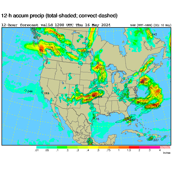
Forecast Maps
Forecast Maps

Aviation Forecast Maps
Computer Models
NCAR Models
Other Sources