 |
| Meteorologist Jim Woodmencey |
The storm that hit Jackson Hole Monday afternoon, on Saint Patrick’s Day, dumped 3 to 6 inches of snow around the valley. A total of 10 to 16 inches of new snow in the mountains, was reported at Jackson Hole and Grand Targhee Tuesday morning, from the previous 24-hours. Most of that snow fell between Noon and 6:00 pm on St. Patty’s Day.
Winds were strong, as well, with gusts of 49 mph at the Jackson Hole Airport and 75 mph at the top of the Tram.
A pretty good snow & blow for late March. Spring Season begins on Thursday!
Some weather maps below from yesterday afternoon & evening.
And the Snowcover Map for USA…..western Wyoming looking the fattest of anywhere.
 |
| Surface Map from Monday Afternoon. Courtesy of MeteoStar. |
 |
| Jet Stream Monday morning. Courtesy of MeteoStar. |
 |
| Pocatello Radar Monday @ 2pm MDT |
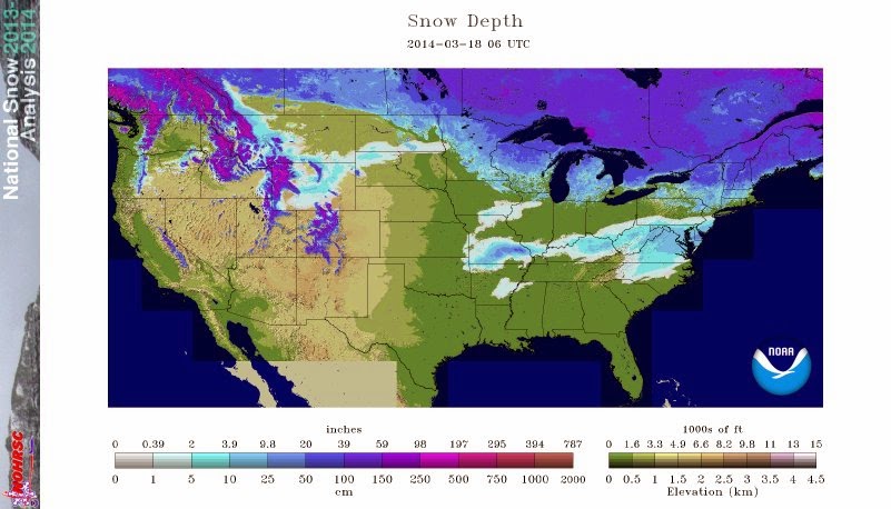 |
| Snowcover Map as of Tuesday March 18, 2014 |
Post by meteorologist Jim Woodmencey
Maps from MeteoStar LEADS On-Line
& NOAA/NWS