 |
| Meteorologist Jim Woodmencey |
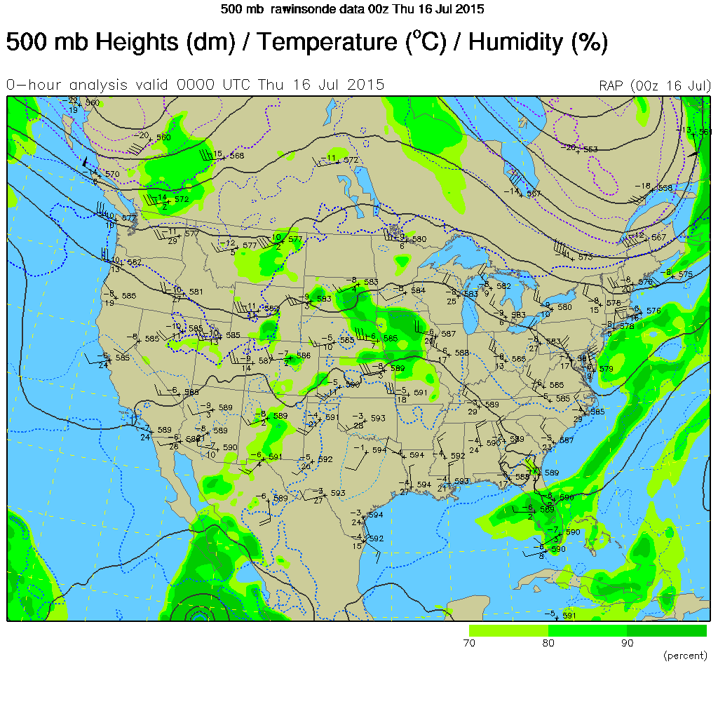
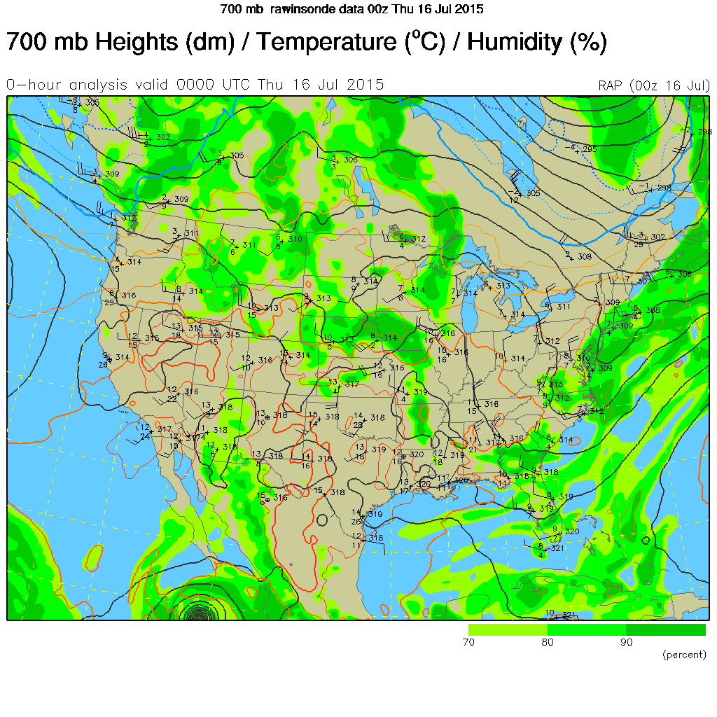
We were underneath a Southwesterly flow this week in western Wyoming out ahead of a Trof of Low-pressure that was over the western US. That kept a decent supply of moist and unstable air overhead that produced late day thunderstorms on Monday, none on Tuesday, and then as that Trof got closer, some rain showers & thunderstorms on Wednesday.
The crescendo of activity was Wednesday evening in Jackson Hole as the cold air aloft within that Trof crossed into western WY, acting just like a cold front passing through. Combine that with the best heating of the day, and good lifting in a Westerly flow over the Tetons, and away ya go!
Some Weather Highlights from Wednesday:
- Between 0.19 & 0.26 inches of rainfall in town.
- Some pea sized hail.
- Wind Gust at the Lower Saddle of 76 mph (at 11,610-ft. elevation).
There was also a decent amount of lightning along the Teton Range, and a few good strikes near town, as well. Below are some images of weather maps during the height of the activity on Wednesday.
 |
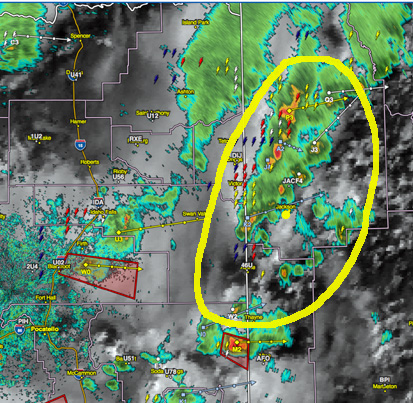 |
| Radar with lightning overlay. Jackson is yellow dot. Yellow circle highlights the whole thunderstorm complex. |
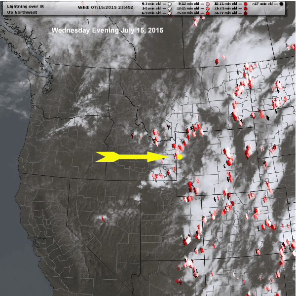 |
| Satellite and lightning strikes, yellow arrow upper level wind direction. Image courtesy of MeteoStar |
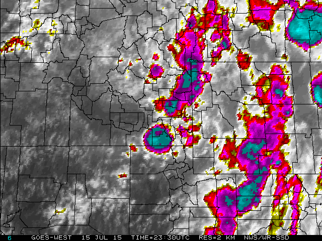 |
| Infra-red satellite image at 5;30 pm MDT |