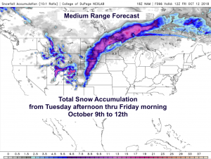
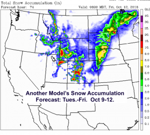
The next few days look to be colder and a bit snowy for parts of Wyoming, northern Utah and Colorado. Central Idaho’s mountains had theirs today for the most part, as a cold upper level Low-pressure moved over Idaho and then stats to sag south into Utah.
See snowfall accumulation forecasts below. Scroll down to see the 700mb maps (@10,000-ft. in the atmosphere) for flow direction, temps and RH the next 3 days.

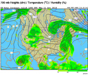
Below is what the flow pattern is forecast to look like Wednesday, Thursday & Friday mornings. Position of Low-pressure favoring SW Wyoming, Northern Utah & Central Colorado for Snow.


Posted by meteorologist Jim Woodmencey