A pretty good flow of Pacific moisture will be blowing inland across the Pacific Northwest this weekend, with progressively cooling temperatures (Nov. 3 & 4). Best shot of snow looks like it will come right at Northwest Wyoming Sunday & Sunday night.
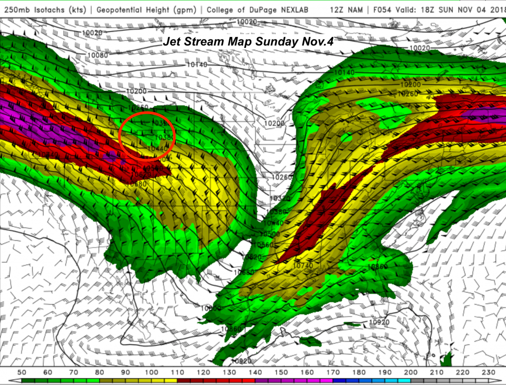
Map below shows the nose of the jet stream at 250mb or 35,000-ft. positioned just south of Jackson Hole. Winds of 100 mph+ over NW Wyoming.
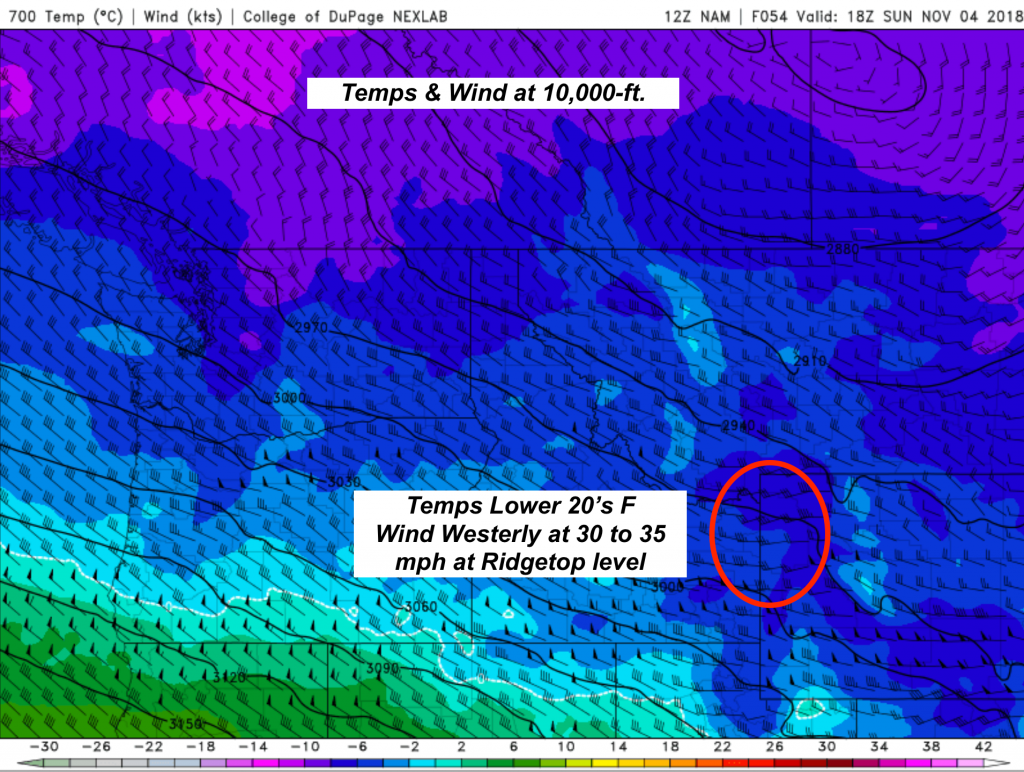
Map below shows the 700mb temps and wind speeds, near the 10,000-ft. elevation. Should be cold enough for snow to valley floor Sunday also.
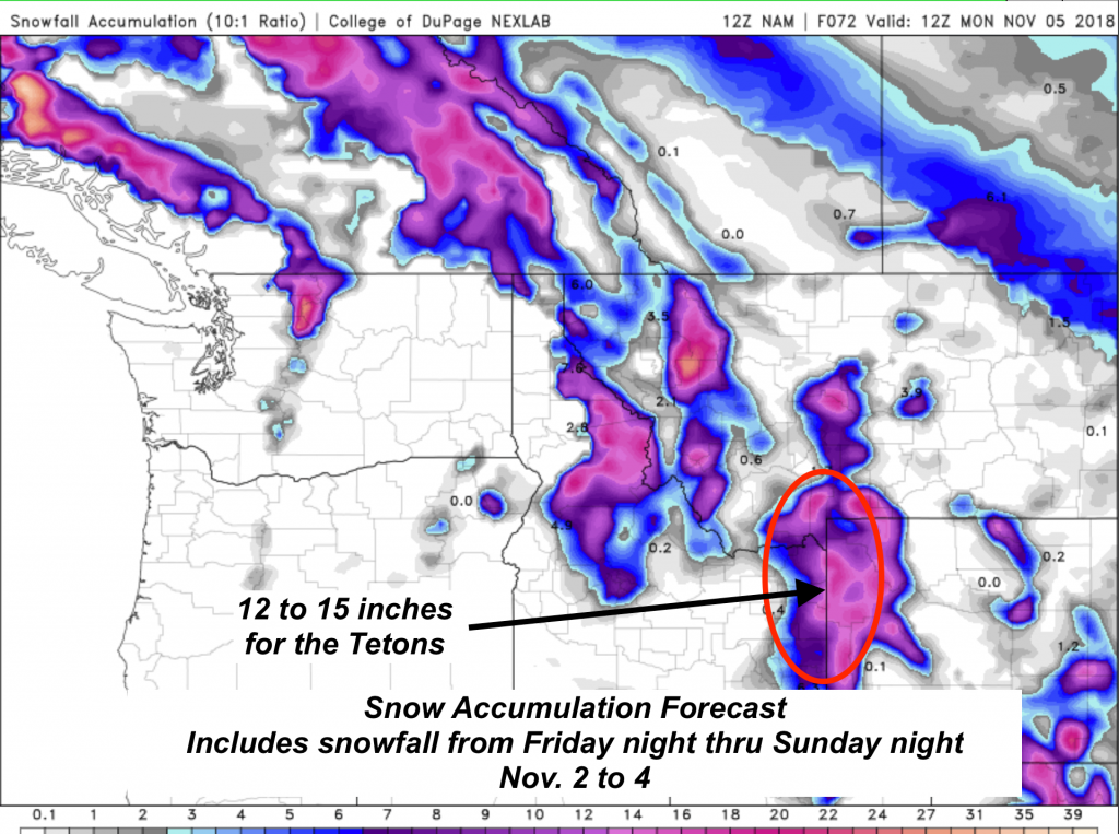
Map below shows Total Snowfall forecast from Friday evening thru Sunday night.
Post by meteorologist Jim Woodmencey