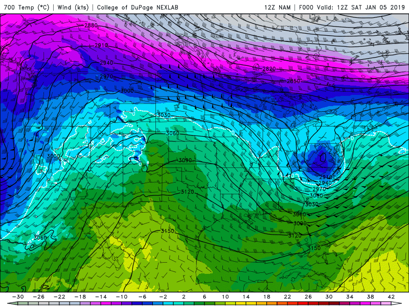
The big, strong Ridge of High pressure that has been parked over the interior of the Western United States this first week of the New Year will finally be breaking down today and that will open the door to some Pacific moisture to move inland Sunday & Monday, January 6 & 7, 2019.
Sunday: Warmer Southwest Flow
A moderately strong and moist Southwesterly flow will extend from the West Coast to the Rockies Saturday night into Sunday morning. That flow is out ahead of a weakening Trof of Low pressure that is currently sitting along the West Coast.
That SW flow will be warming temps at all elevations, as valley inversions, like we have seen in Jackson Hole all week, will finally be broken. Snowfall beginning Saturday night and into Monday afternoon across the Northern Rockies.
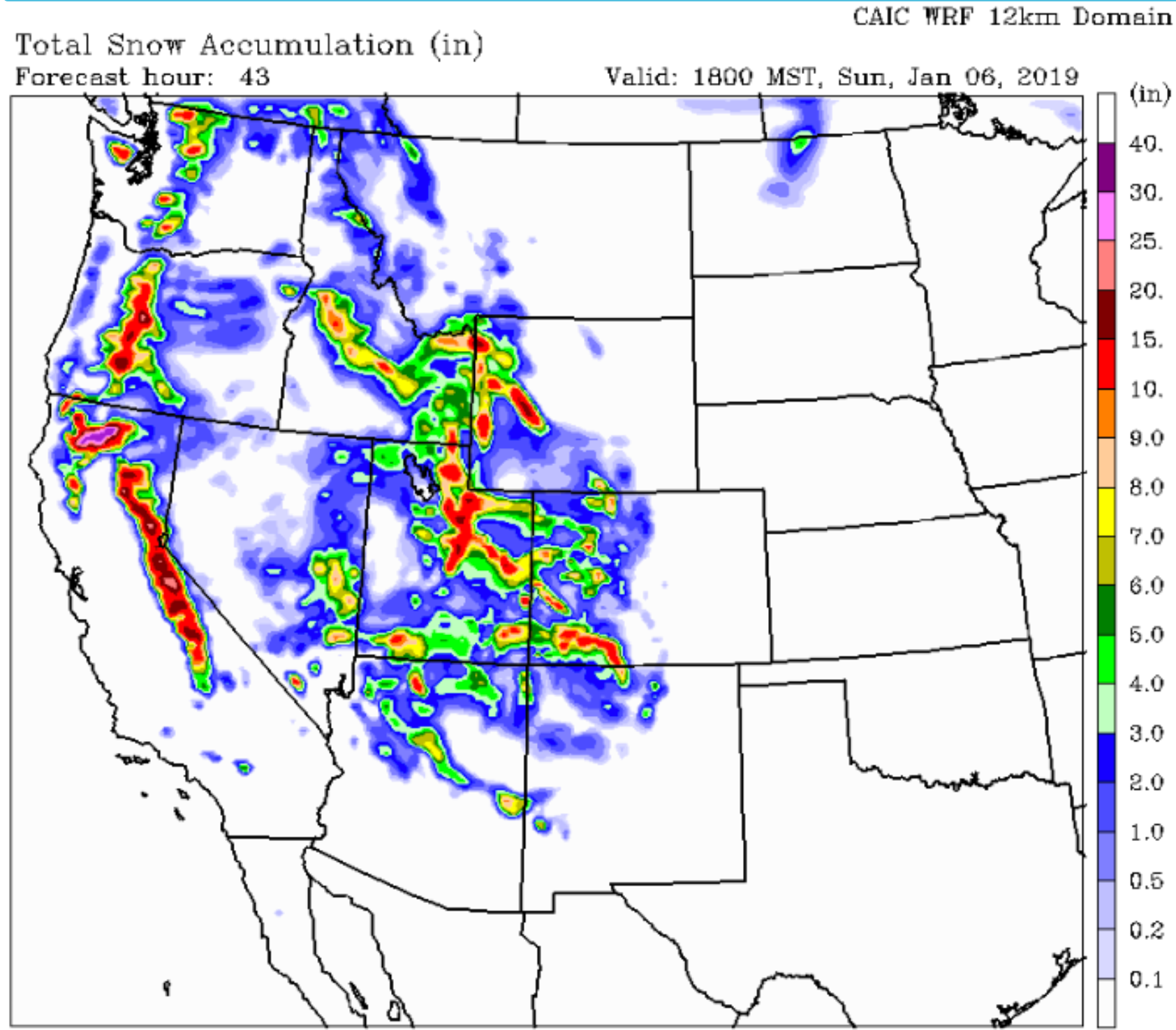
Snow accumulation from Saturday night Sunday afternoon on map below.
Monday: Cooler Westerly Flow
A stronger Westerly flow will bring a little more moisture inland late Sunday into early Monday. That will bring another shot of Pacific moisture, along with cooler temps aloft….like single digits at 10,000-ft. on Monday.
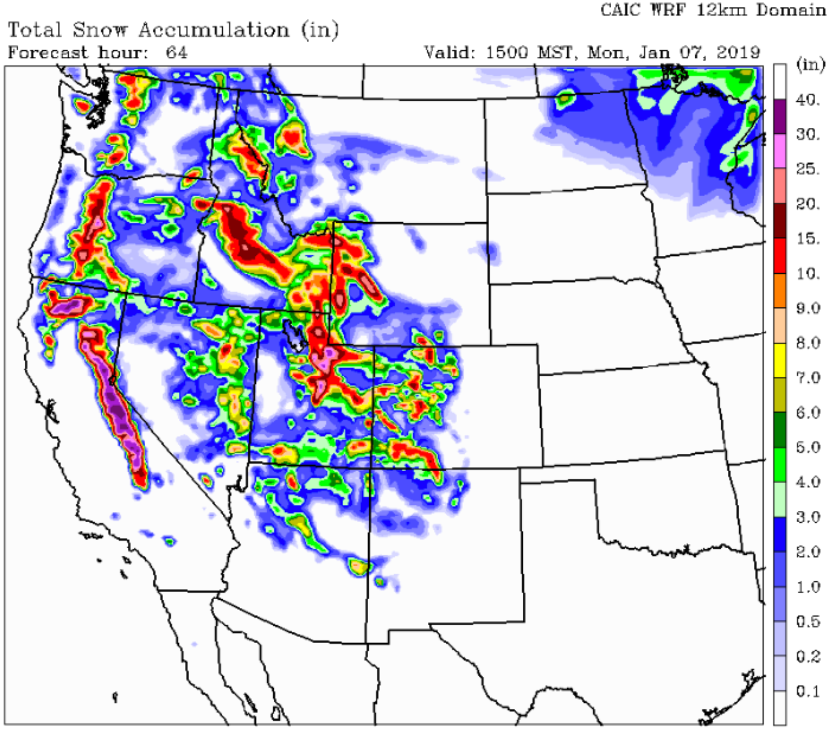
Total snow accumulation, Saturday night thru Monday afternoon on map below.
USA Snow Accumulation Saturday thru Monday, in video loop below.
Bottom Line is:
The Sierra Nevada range will do best with this weather pattern this weekend, with 2 feet or more at the higher elevations. The Cascades of WA & OR will also do pretty good.
The Tetons & Wind River Ranges in WY , the Wasatch & Bear River ranges in UT & the San Juan mountains of SW CO do good too, with a foot or more of new snow accumulation by end of day Monday.
Back to a weaker, Ridge of high pressure on Tuesday, the way it looks right now.
Post by meteorologist Jim Woodmencey