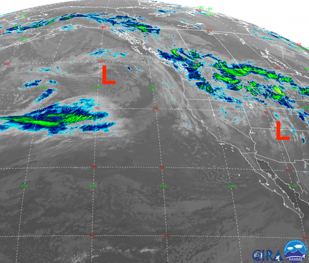
Large Low-pressure system on West Coast will continue to cycle clouds and precipitation in and over the Western U.S. and Rockies through the weekend. Rain at lower elevations & snow in the mountains, generally above the 6000-7000-ft. elevations.
Current Situation
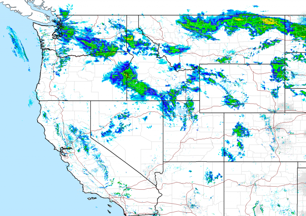
Below are this morning’s Satellite & Radar Images: Friday May 17, 2019
Weekend Forecast
Below is an animation of the clouds (represented by gray & white colors) and precipitation (blue-green colors), along with surface pressure contours (white lines in millibars). Video courtesy of Windy.com
Click on image below to view forecast maps from: Friday noon to Sunday evening.
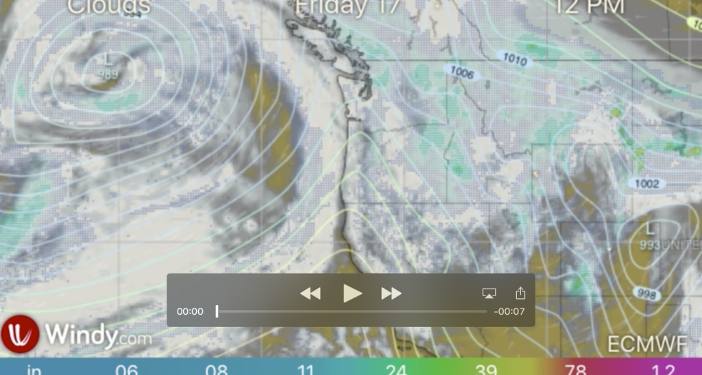
Big Low-pressure rotates moisture inland in pulses, with plenty of clouds & showers each day, Friday through Sunday. Expect periods of heavier rainfall, and just a few breaks in the clouds & showers.
Also, much cold air is coming inland, cold enough in Jackson Hole for the possibility of some snow to the valley floor.
Another Low-pressure center in the Gulf of Alaska will be moving inland later Sunday and affecting the weather across the Western U.S. for most of next week, keeping it wet & cool.
Post by meteorologist Jim Woodmencey