|
| Meteorologist Jim Woodmencey |
As much as I hate to sensationalize the weather, this afternoon’s thunderstorms were pretty cool to observe. Between 3:30 and 4:00 pm a series of thunderstorms moved through the Jackson Hole area that produced hail 3/4 of an inch to one inch in diameter, measured in the Town of Jackson.
While we did not receive a lot of rain (we actually had less than 0.10 inches in Town, even with this morning’s rain), it was the size of the hail that qualified this as a “Severe” storm, by the National Weather Service definition:
“Severe Thunderstorms produce large hail, at least one inch in diameter, and/or damaging winds, at least 58 mph (50 knots).”
The best thing about today’s thunderstorms, is that they were well forecasted. My own MountainWeather Forecast for Jackson Hole had the probability of thunderstorms at 90% (rarely do I peg it at 100%!) with “Moderate” amounts of lightning, meaning several ground strikes would be likely with thunderstorms.
AND….. the National Weather Service was also right-on with this one, with the National Storm Prediction Center forecast map for the day, and the Riverton NWS Office issuing a a Special Weather Alert very early this morning warning of strong thunderstorms and dangerous lightning, and telling people to get out of the hills and seek shelter early this afternoon. Good Work NWS!
 |
| National Forecast Map from This Morning |
|
More Images
A selection of weather maps is cataloged below, capturing the satellite, radar, and lightning that was occurring just prior to and during this weather event. Days like this make it fun to be a weather nerd! Shouldn’t be outside anyway, so might as well look at the weather on the computer, eh?
–>
 |
| National Lightning Strike Map at 2:45 pm Wednesday, less than 1 hour prior to Jackson storm. Graphic courtesy of MeteoStar LEADS On-Line |
|
 |
| Infra-Red Satellite Photo at 2:30 pm |
|
 |
| Visible Satellite Photo at 3:00 pm |
|
 |
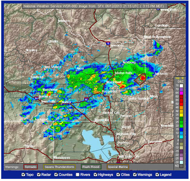
Pocatello Radar Image at 3:15 pm
(Note the severe thunderstorm & tornado boxes just Southwest of Jackson) |
|
 |
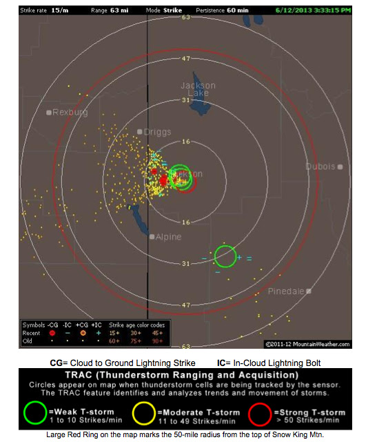
Image from the MountainWeather Lightning Detector on Top of Snow King Mountain
at around 3:30 pm |
|
 |
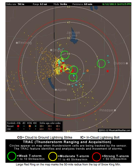
Image from lightning detector about the time hail was falling in town
and thunderstorm was right overhead |
|
 |
| Hailstone |
|