POSTED: August 15, 2017
A word from meteorologist Jim Woodmencey on the 6 to 10-Day Outlook Maps:
As it might relate to the Eclipse date of August 21st… The outlook for the days immediately surrounding the Eclipse are now showing that most of Oregon, all of Idaho and western Wyoming fall under the “Normal” category, which means there is an equal chance of there being above, below, or normal precipitation during that 5-Day time period the forecast is valid for (33% chance each category). Central & Eastern Wyoming are still sitting under the below normal precipitation category.
You good glean from these predictions that the areas with a higher probability of seeing below normal precipitation would have a greater chance of having less cloudiness. Areas under a higher probability of having above normal precipitation may have a greater chance of seeing more cloudiness during this time period. That would include SE Nebraska, Missouri, and South Caroline, under the path of totality.
As far as temperatures go, Idaho & Wyoming are now showing “Normal” temps for the week, which I am not sure that means anything, as far as cloud cover is concerned.
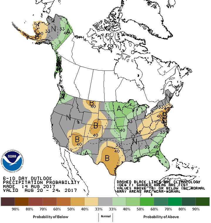
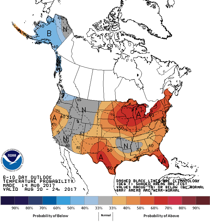
How to Read the 6 to 10 Day Outlook Maps from the NWS
| The 6-10 day Outlook gives the confidence that a forecaster has, given as a probability, that the observed total precipitation, over upcoming days 6, 7, 8, 9 and 10 will be in the range of one of three possible categories – below (B), median* (N), or above (A). For any calendar 5-day period, these categories can be defined by separating the 30 years of the climatology period, 1981-2010 (30 years), into the driest 10 years, the middle 10 years, and the wettest 10 years*.
Because each of these categories occurs 1/3 of the time (10 times) during 1981-2010, for any particular calendar 5-day period, the probability of any category being selected at random from the 1981-2010 set of 30 observations is one in three (1/3), or 33.33%. This is also called the climatological probability. The sum of the climatological probabilities of the three categories is 100%. Graphical Information The colored shading on the map indicates the degree of confidence the forecaster has in the category indicated, where “B” and brown colors indicate “below-median” and “A” and green colors indicate “above-median”. The darker the shading, the greater is the level of confidence. The numbers labeling the contours separating different shades gives the probability that the indicated category (A, B, or N) will occur. The probabilities of all three categories are implied on the map, and sum to 100%. The forecast probabilities given on the map generally fall far short of complete confidence (100%) in any single category. When the probability of the above (A) or below (B) category is greater than 33.33% by some amount, the probability of the opposite category declines by that amount, while the probability of the middle category remains at 33.33%. In the event that the “N” category is greater than 33.33%, the probabilities of both the “A” and “B” categories is each reduced by 1/2 the amount that the “N” category exceeds 33.33%. When the probability of “A”, or “B” reaches 63.33% or higher, the odds of the opposite category reach a minimum allowed value of 3.33%, while the odds of the middle category are allowed to drop below 33.33%. The dashed contours on the map give the average of the total precipitation over the set of 30 observations for the calendar 5-day period during 1981-2010, in inches. * Because most precipitation observations lie on the dry side of the mean, we use the median, instead of the mean, to express the central tendency of precipitation. |