Low-pressure moves inland from the Pacific Northwest Coast and settles in over the Great Basin for the Father’s Day Weekend. More clouds and scattered showers & Thunderstorms will be generated as moist and relatively unstable air is circulated over the Rockies, Friday thru Monday (June 15 to 18).
The flow aloft over western Wyoming and Jackson Hole will be coming out of the South (Southwest to Southeast) this weekend, so be on the lookout for moisture & T-storms generally tracking from those directions, especially over the surrounding mountains.
Forecast of this weekend’s precipitation is shown in the map below. Click the image to run a loop of the accumulating precip amount, every 3-hours, from Friday Noon to Monday Noon, June 15 to 18. (This is just one model’s interpretation, from CAIC).
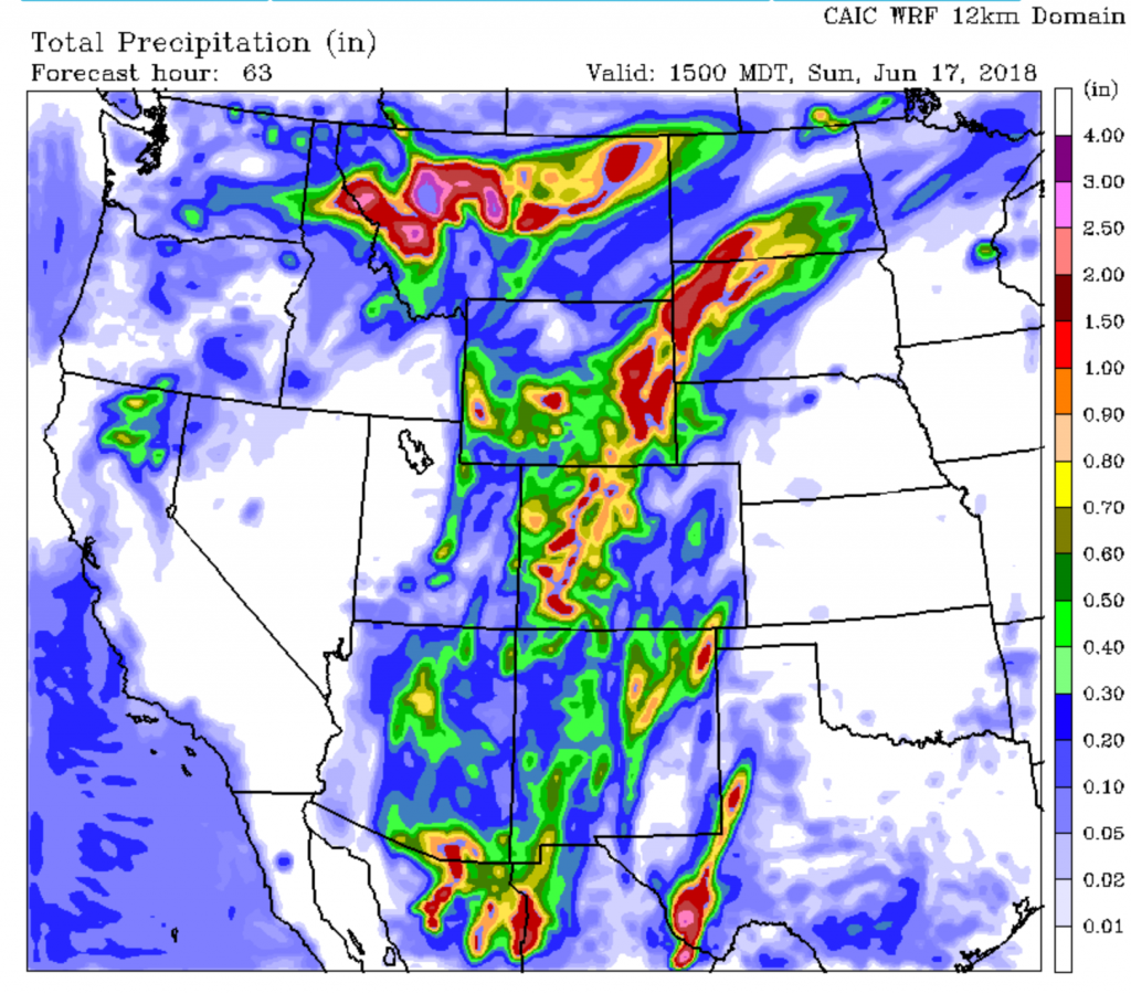
Central & Eastern Wyoming in this model’s prediction seemed to get more precip Saturday night/ Sunday morning. Southwestern Wyoming & the Jackson Hole area seem to get the most precip later Sunday & early Monday.
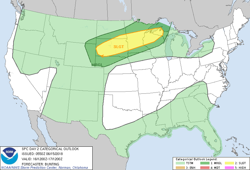
Here are the Convective Outlook Maps for Saturday & Sunday. These maps display areas with a risk of Thunderstorms. Thunderstorm coverage over the Rockies is widespread, but risk of strong thunderstorms is limited to areas east of the Rockies.