In General:
The weather across the western U.S. this Memorial Day Weekend won’t be all bad, but it would be hard to call it “good”.
One large, cold trough of Low-pressure will move east of the Rockies Friday. Thursday’s jet stream map below, showing how far south the Low & the jet have been this week.
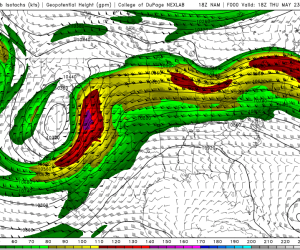
Now, click on the map above to see the jet stream pattern through Sunday night, May 26th. Once the current Low exits, another Low-pressure moves inland over the Pacific Northwest, which will take another dive towards the Southwestern U.S. The weather pattern the next few days reminds me of a softball pitcher winding up……
That keeps the temps seasonably cooler through Memorial Day over the West, along with showers, thunderstorms and some mountain snow in the picture.
Yes I said, “Snow”!
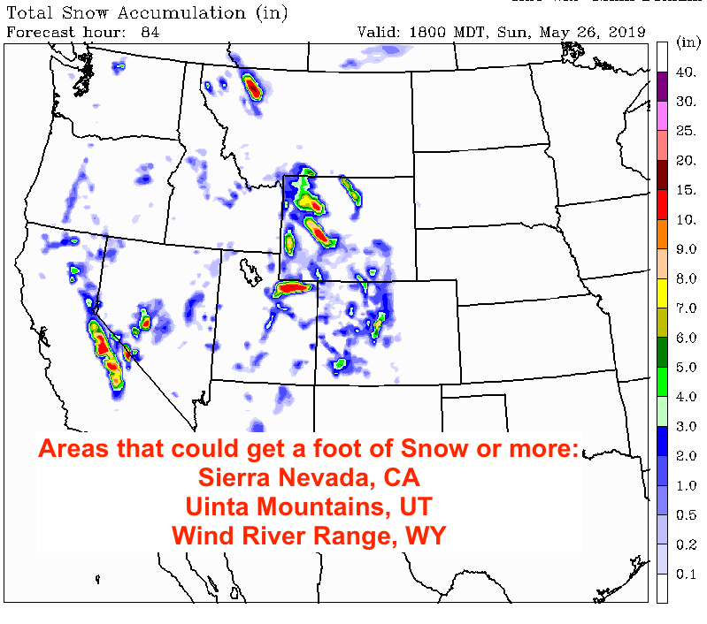
More cold and more snow for late May 2019. Click Map below for a loop of where, when and how much snow the Western mountains are forecast to get.
Map below shows total accumulation through Sunday afternoon.
In Western Wyoming:
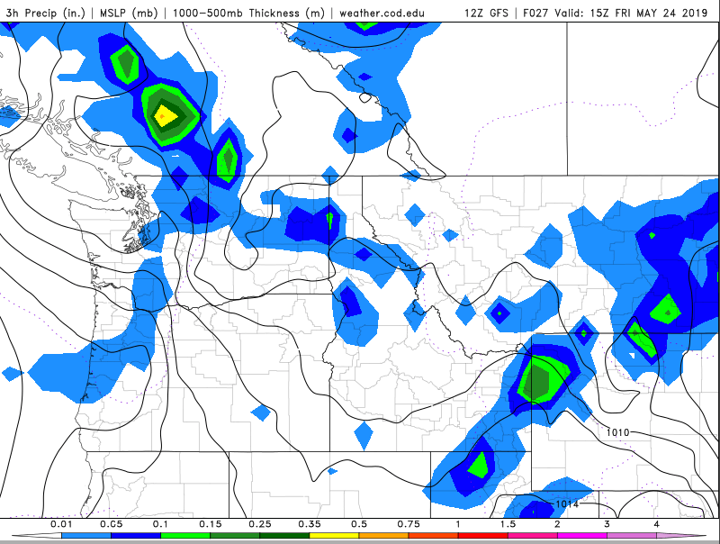
Moisture will again be pulsing across western Wyoming this weekend. Expect showers, heaviest rain looks to be coming on Friday. Maybe another dousing Saturday afternoon. Scattered showers for Sunday & Monday, a little less wet?
Check the forecast for Jackson Hole & the Tetons for more detailed & updated info.
Click on map below for the forecast precipitation, for each 3-hour increment, from Thursday afternoon to Monday afternoon, for the Northwest portion of the U.S.
Find your breaks to get outside!
Post by meteorologist Jim Woodmencey