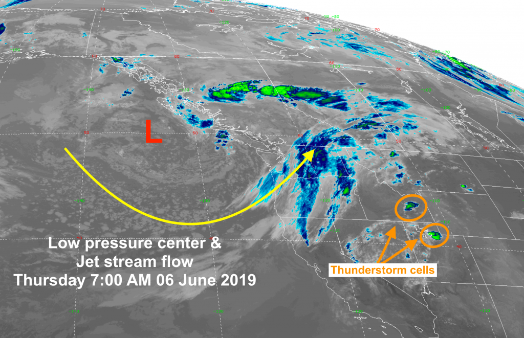
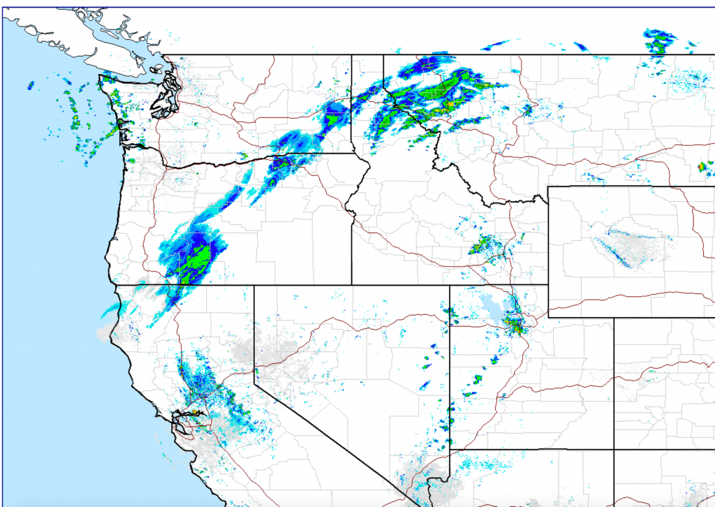
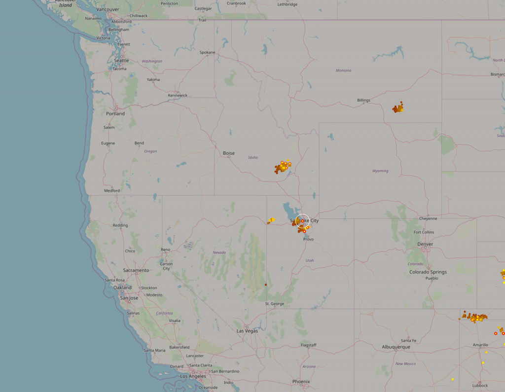
Weather is changing across the Western U.S. for the weekend…..Warm air in place ahead of a cold Low-pressure center positioned off the Pacific Northwest coast this morning. Isolated areas of early morning Thunderstorms started popping up at sunrise. An indication that the atmosphere is already quite unstable.
Satellite & Radar Images, plus lightning strike map from @ 0700 MDT Thursday, June 6th, 2019 below. (Today is the 75th Anniversary of D-Day, by the way).
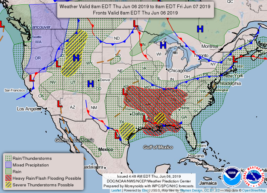
Below is Thursday’s Forecast Weather Map across the USA. Click the map to view the general weather outlook for next 3-days…..
Further updates on this weekend’s weather situation coming on Friday morning….
Post by meteorologist Jim Woodmencey