The outlook for fresh powder in the Western United States between Christmas and New Year’s Day is not looking too cheery for many locations.
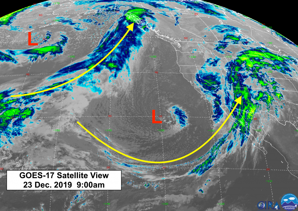
A split jet stream flow in the Pacific will send three separate Low pressure systems on a southerly track across the Southwestern U.S. That will favor the southern Sierra Nevada (Mammoth) and the San Juan Mountains (Telluride) for snowfall.
In the northern Gulf of Alaska, more of a West to Sw flow wil bring plentiful moisture & the biggest snow accumulations across British Columbia, Canada’s mountains.
Current Satellite map Monday morning Dec. 23rd, 2019:
SNOWFALL FORECASTS
Short-term and longer term forecasts below for total snow accumulations.
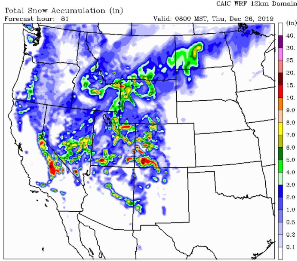
First up is from The Colorado Avalanche Information Center’s WRF model, with snow accumulations through Christmas Night. Looks like theirs is the most optimistic, with 4 to 7 inches for the Teton Mountains & about 3 to 4 inches for the Jackson Hole Valley.
A little more for the Wasatch Mountains & Yellowstone Park. The Uinta Mountains of Utah, Southern Sierra & San Juan Mountains of Colorado look to get the most, with a foot or more.
Looking just beyond New Year’s Day, the 10-day snowfall forecast from the European model shows only a little more snow most places in the West. British Columbia scores the most snow.
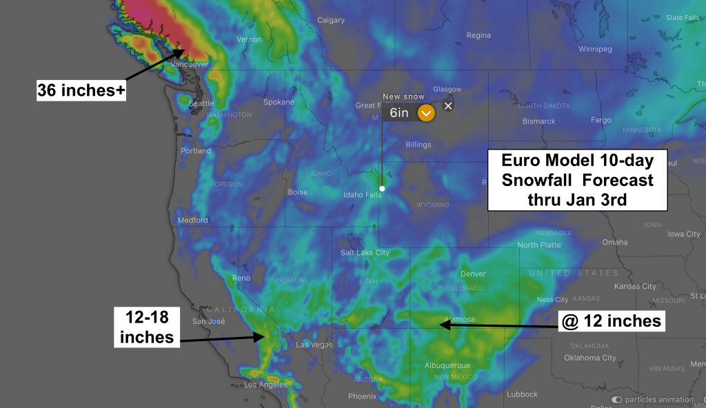
The weather patter looks like it finally changes to something more favorable for the northern Rockies by the end of the first week in January 2020.
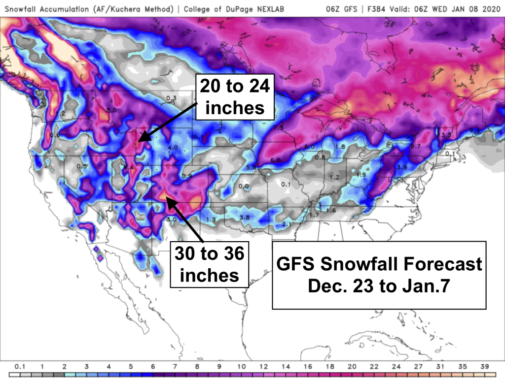
Below is the GFS model snowfall accumulation forecast for Dec. 23, 2019 to Jan. 7, 2020. The bulk of that snowfall for the Tetons comes between January 5th & 7th.
Merry Christmas & Happy New Year!
Post by meteorologist Jim Woodmencey