You may not be aware of it, but today, February 5th is National Weatherpersons Day. Celebrate with your favorite meteorologist, buy him or her a beer! This is also the beginning of a steady Northwesterly flow or “Dirty Ridge” event for the northern Rockies.
As a Ridge of High pressure parks off the West Coast and a stream of moisture rides up and over the top of that Ridge, it mixes with relatively cool air from the Gulf of Alaska to make a good period of orographically enhanced snowfall.
In layperson’s terms, that means the mountains get a good dump of relatively low-density powder. Situation and snowfall accumulation forecasts below.
Satellite Wednesday AM

Short-Term Snow Forecast: Wednesday

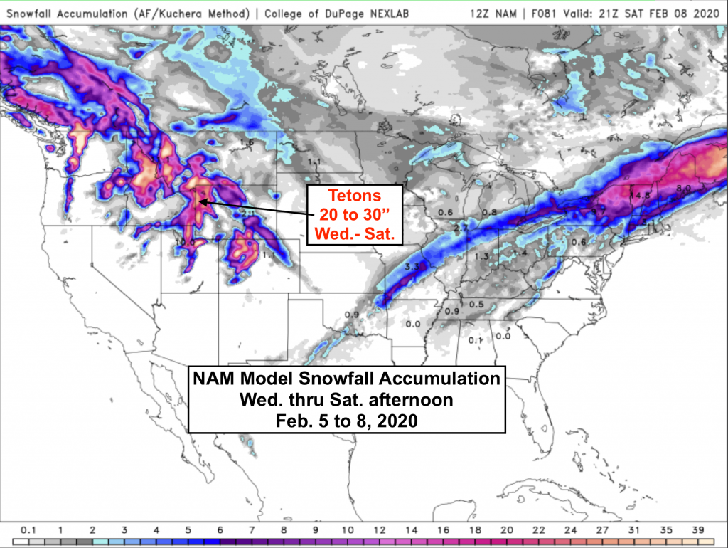
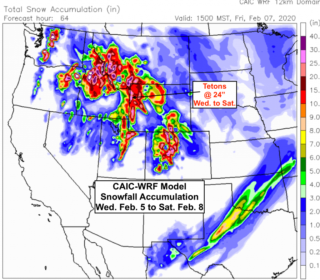
Longer Term Snow Forecasts: Wednesday-Saturday
I will update this again Thursday, as a good looking little Low-pressure system moves into Washington & Oregon, bringing a West to NW flow over western Wyoming later in the weekend. That’ll keep the powder coming.
Post by meteorologist Jim Woodmencey