Every year in early autumn I will present some sort of prognostication of what the coming winter will be like. For skiers, snowboarders and snow-machiners, in general, all they really care about is that it will be a “SNOWY'” winter, providing bountiful powder to shred.
That’s the only reason to even look at a long-range forecast, in my opinion. To either give hope or spread despair as we wait in anticipation of the coming winter. Here is what i found, take it for what it is and don’t hold me personally responsible if it does or doesn’t come true!
What NOAA Says
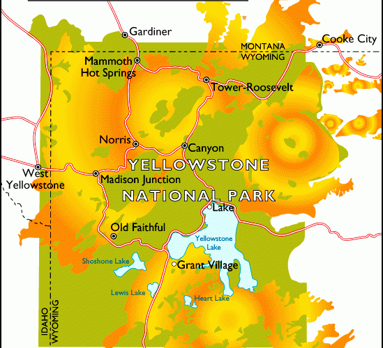
The latest forecasts from NOAA’s Climate Prediction Center, made Sept. 17th, 2020, are showing that temperatures in Northwest Wyoming have an equal chance of being above normal, below normal or normal. No help there, as far as determining if it will be colder or warmer than the averages around Jackson Hole.
It might be worth noting that last year the same winter outlook issued by NOAA gave us a 50 to 55-percent chance of having warmer than normal temperatures. It turned out to be cooler than normal last winter.
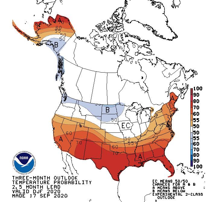
For Northern Washington State & northern Montana, it shows colder than normal. For the Sierra Nevada to Utah & Colorado, warmer than normal temps are anticipated.
Their prediction for precipitation this winter shows a better than even chance of above normal. Jackson Hole is somewhere between a 55 and 60-percent probability of seeing more precipitation than normal. Which we could interpret to mean, snowier than normal this winter.
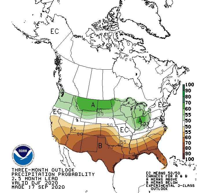
Last year, NOAA also showed equal chances of above, below or normal precipitation last winter. We had above normal snowfall, both in town and in the mountains during the Winter of 2019-20.
Montana looks to have the highest probability of SNOWIER than normal winter in 2020-21. The Pacific Northwest, is riding the 50 to 55-percent probability line for above normal precip. For the rest of the Southwest, it looks drier. Utah and Colorado are on the line of Equal Chances or land somewhere near the 50 to 55-percent probability of seeing below normal precip this winter.
What the Farmers Say
Last year, both of the almanacs touted a colder and snowier winter for our region. Check them off as being correct in their predictions for last winter.
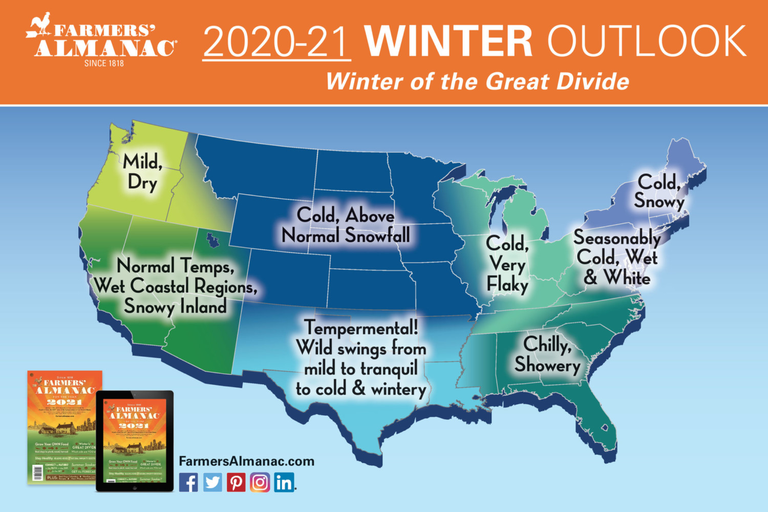
This year, the Farmers’ Almanac is painting a picture of “Cold, Above Normal Snowfall”, across all of Wyoming for Winter 2020-21. Read no further if that is what you were waiting to hear.
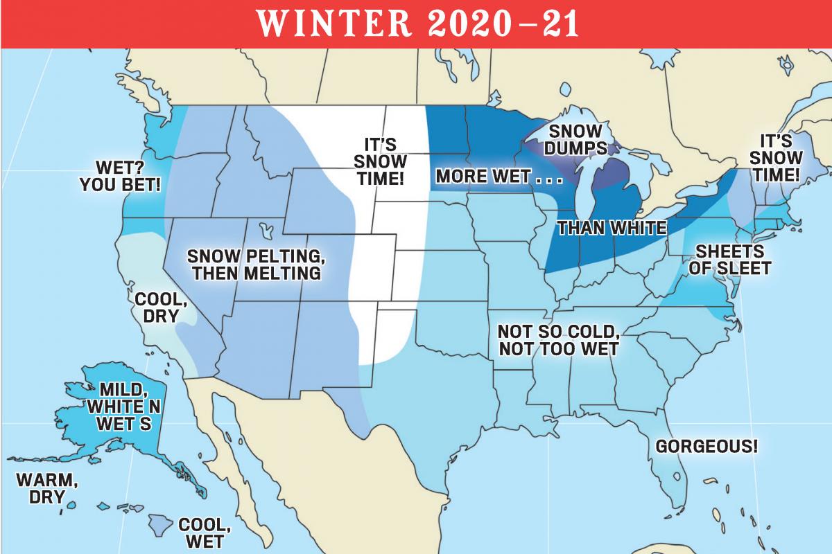
The Old Farmer’s Almanac is a little more ambiguous in their outlook for western Wyoming, displaying, “Snow Pelting, Then Melting” on their outlook map. Could that portend warmer temperatures at times? Perhaps. Nevertheless, it’s not quite as assuring as their forecast from last winter, which read, “Low Temps, Deep Powder”, which pretty much was a dream come true for us here in Jackson Hole.
The bottom-line is that none of this winter’s prognostications are totally discouraging for Jackson Hole or for most of the mountain regions of the Western U.S.
All of them are a far cry from saying, “warm and dry”, except for maybe teh Southwestern part of the country. So, youbetter prep those boards, snow’s coming.
La Nina on Track
Since August of 2020, La Nina conditions developed in the Equatorial Pacific Ocean. La Nina is the cool phase of the El Nino Southern Oscillation or ENSO.
Forecasters at NOAA who pay attention to these sorts of things are predicting a 75-percent chance that La Nina conditions will continue through the Northern Hemisphere winter.
Typically, and I use that word with a dash of caution, La Nina winters are drier and warmer over California and the Southwestern United States. La Nina Winters are typically cooler and snowier for the Pacific Northwest and Northern Rockies.
Based on that prediction, along with what I can glean from all the other outlooks, I’d conclude that we are in for another pretty good winter season, especially around Jackson Hole. As I like to say though, a bad winter in Jackson is usually better than a good winter most other places. But I’m a little biased that way!
Post by meteorologist Jim Woodmencey