 |
| Meteorologist Jim Woodmencey |
It can be a game of inches sometimes on the weather map. A stationary front that lies across central Idaho and Northwest Wyoming is separating cold air to the north of that line from warmer air to the south of that line.
This morning (Tuesday Feb. 25), temperatures in Southwest Montana are between 6 and 12 degrees, north of that in Great Falls, MT it is 9 below zero!
Temperatures in Southeast Idaho and Western Wyoming are between 35 and 40 degrees.
Snowing pretty heartily to the north of that line, from Dillon to Billings. Some rain showers at lower elevations to the south of that line, with some snow falling at higher elevations. Let’s root for that line to shift back to the south a few inches today and bring Jackson Hole a little shot of snow!
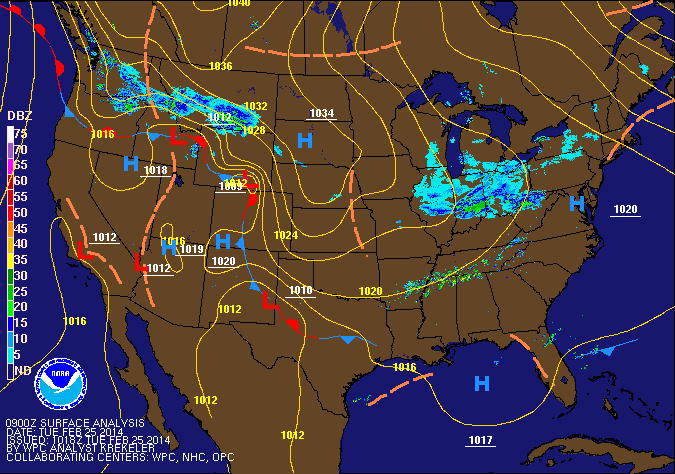 |
| Surface Weather Map with Fronts & Radar. Tuesday, February 25, 2014 at 3:00 am MST |
Further south of that stationary front, it is just warm and dry across California, Nevada, Utah, and western Colorado.
By the way, it was along that same stationary front that we saw copious amounts of snow in Jackson Hole/Tetons over the weekend, when we were on the colder side of that line.
Post by meteorologist Jim Woodmencey
Map from NOAA