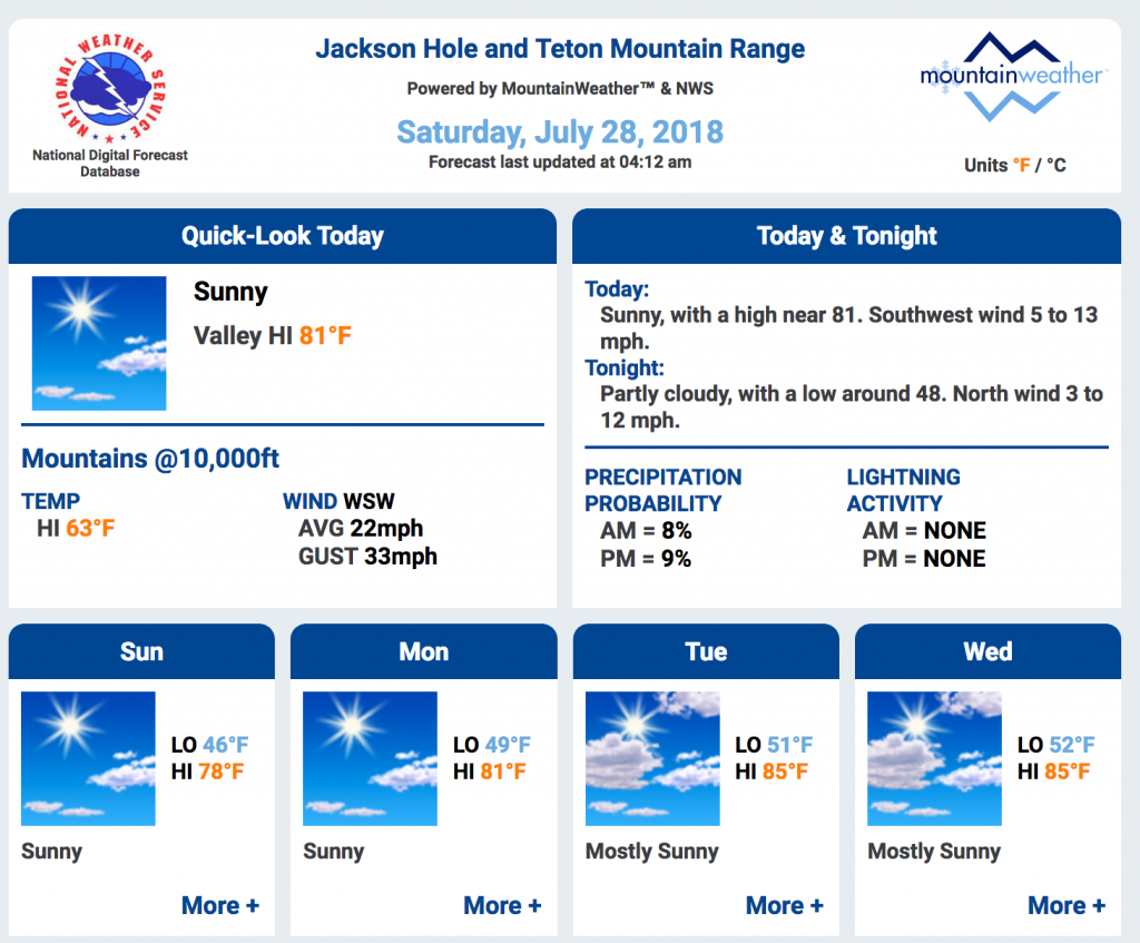
If you woke up this Saturday morning in the Town of Jackson to the pitter-patter of rain, you might have been as surprised as I was. Seeing as there was no mention of any chance of showers in the forecast, for the previous three days! No showers were even mentioned in the forecast for Jackson in the forecast issued just a few hours before,. Precipitation probability in the mountains was only 8% this morning!!
Models Missed it
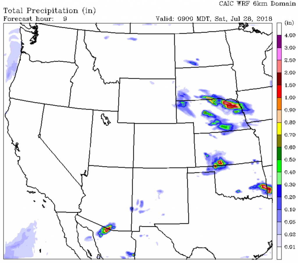
I went back and looked at several different computer models and none of them had any precip here for Saturday morning. One of the highest resolution models ran just 6 hours previous to the passing showers. Like the one below. Image is for total precip between 6:00 am and 9:00 am Saturday. (Click for a loop).
Very perplexing when in this day and age weather forecasts are supposed to be getting better, more sophisticated and are running at very high resolutions. But, every once in a while things like this, on this small a scale, can fall through the cracks and be missed, even by the best computer models.
Real Images
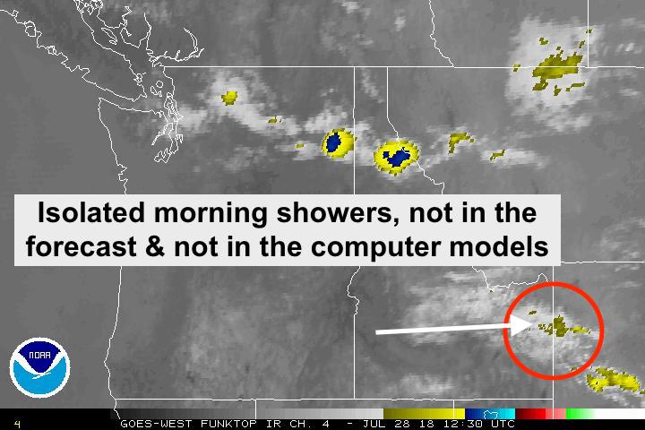
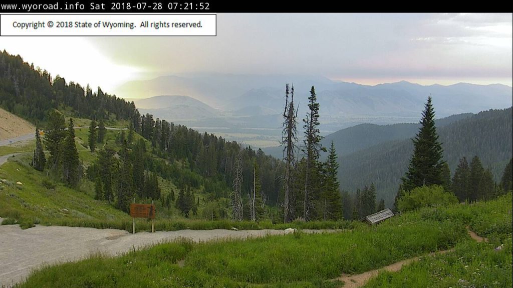
The reality is in the images below, from the Infra-Red Satellite and a screenshot from the Teton Pass webcam.
The Only Indicator
If you have read this far, I will hit you with some more technical stuff about why the showers occurred and what the computer models missed.
There was some high level moisture (500mb), loosely connected to monsoon moisture near the Four-Corners. That moisture was scheduled to move over eastern Idaho and NW Wyoming in the models on Saturday morning. There was also enough instability in the atmosphere, which was not being generated by afternoon heating, thus confirming the likelihood of monsoon moisture.
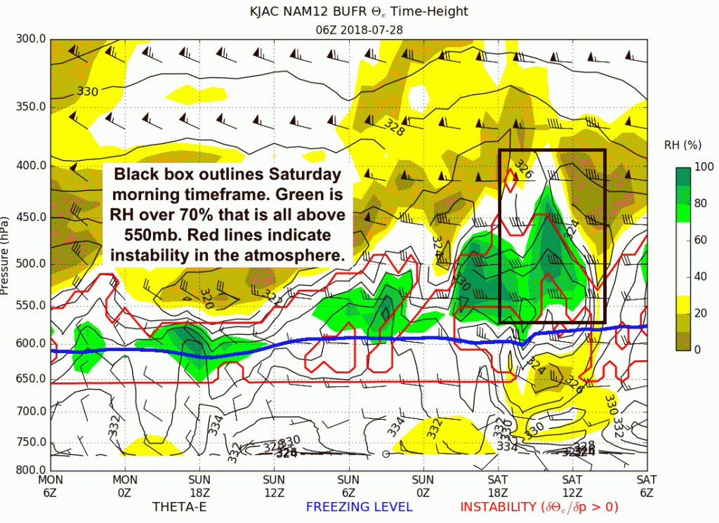
There was one weather forecast product that I used when I was making my own forecasts for Jackson that showed this pretty clearly, with enough RH around 500mb and instability in the morning hours (12Z is 6:00 a.m. MDT).
See the Time-Height Cross Section product below, generated for Jackson, WY from Univ. of Utah.
Somehow, the computer models did not have the ability to put these pieces together and at least generate a forecast that had some chance of showers. Oh well, so much for weather science getting better. As I like to say, especially during baseball season, “Mother Nature always gets to bat last!”
Posted July 28, 2018 by meteorologist Jim Woodmencey.