Is this going to be the endless winter? Today is officially the last day of Spring.
Friday at 9:54 AM MDT the Summer Solstice occurs and in the Rocky Mountains of Montana, Wyoming & northern Colorado, Summer 2019 is going to begin with some fresh snow!
Click Image below to see the forecast snow accumulation across the Northwestern U.S. from Thursday morning June 20th through Sunday morning June 23rd.
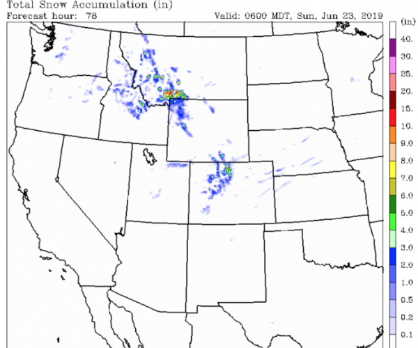
It looks like the mountains of Southwestern Montana get the most accumulation, 7 to 11 inches possible at the higher elevations. Yellowstone Park, the Wind River Range and north-central Colorado’s mountains might see 3 to 6 inches of new snow to begin the summer season.
Cold Low-Pressure for June
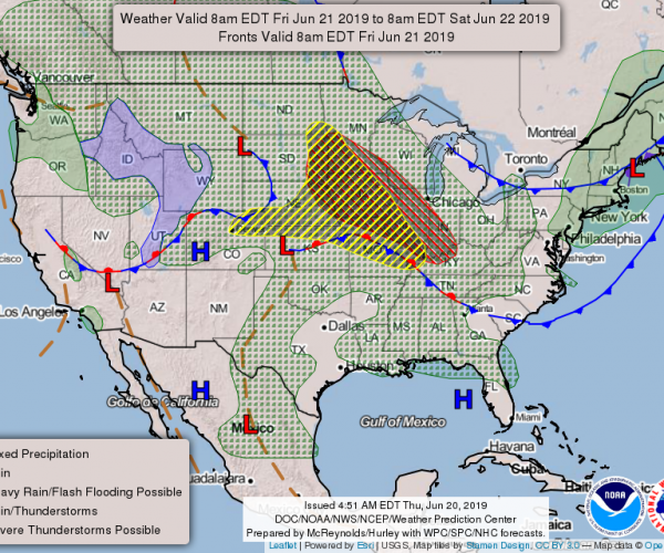
This is all due to a very cold Low-pressure center in British Columbia that is swinging across the NW U.S. the next few days. Below is the general forecast map for the United States on Friday, June 21st, 2019. The first day of summer.
Also read the previous blog about: Very Cold Summer Solstice
Post by meteorologist Jim Woodmencey