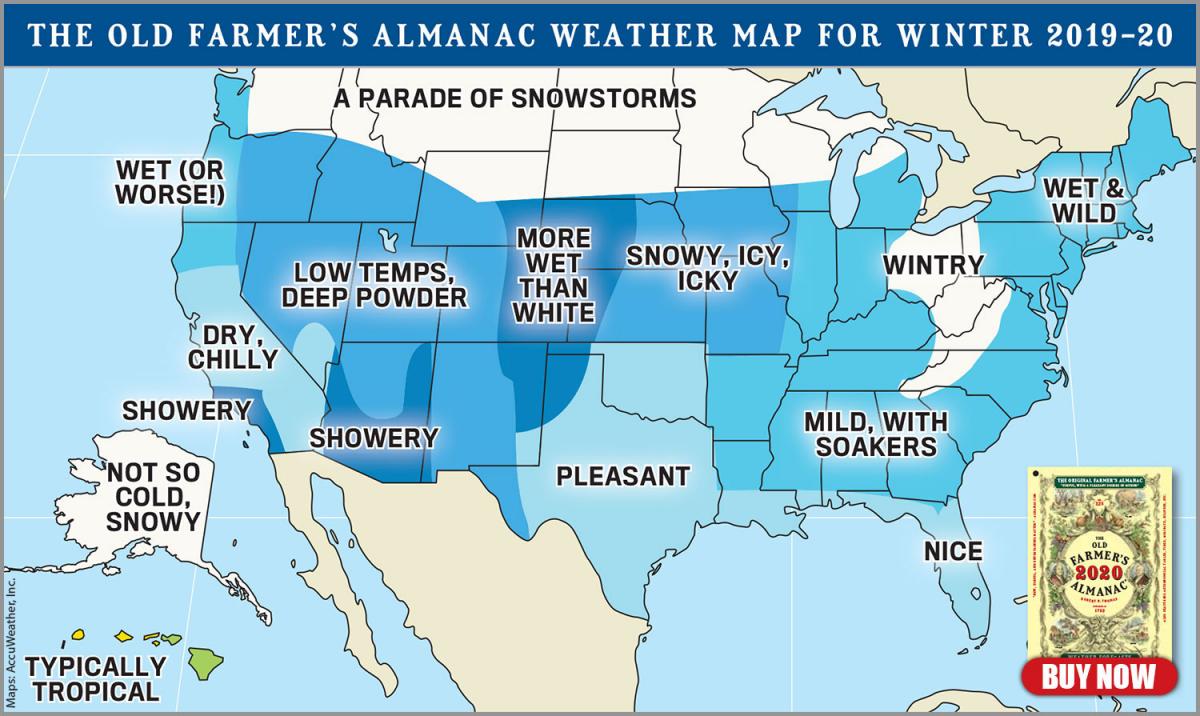
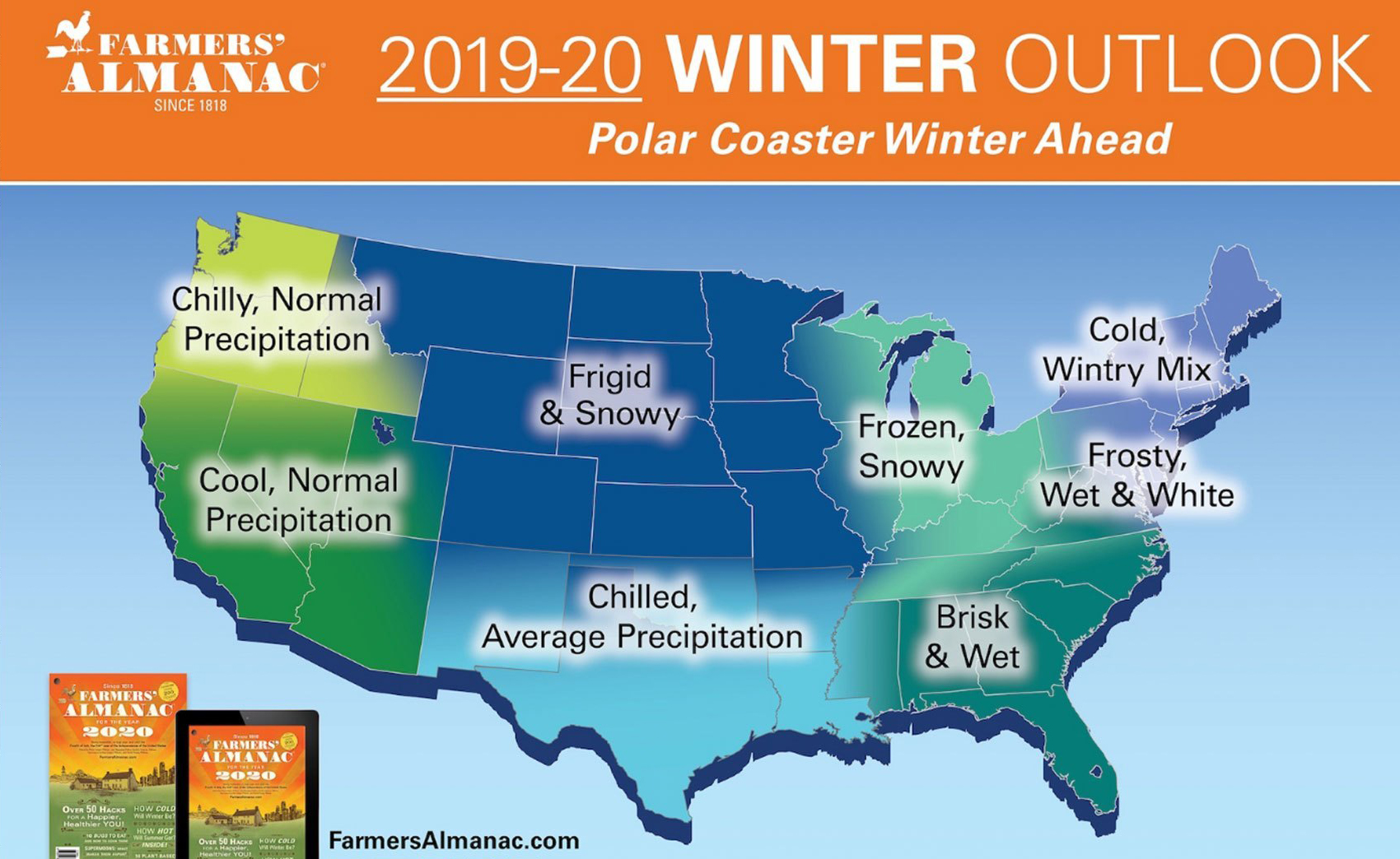
Back in early September I did my first outlook for the winter season in this blog. That was just after the Farmer’s Almanacs came out with their predictions. Two of those Almanac forecasts had most of the Mountain West painted under cooler and snowier conditions, overall. Those forecasts don’t change, once they are published in late August. (See their maps below).
The Climate Prediction Center (CPC) forecast that I reviewed from NOAA, that was issued in mid-August, revealed that the western U.S. would be warmer than normal, but was undecided about precipitation. That outlook was non-committal about it being above, below, or normal for precipitation for the three-month period, they gave it “equal chances” for each. No help there. However, the latest update looks a little different.
Latest Look
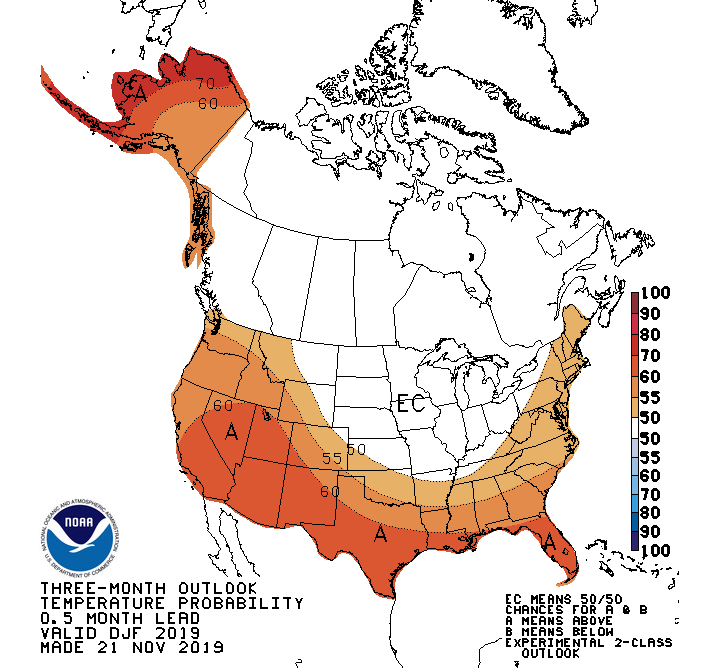
The newest three-month long-range outlook from the Climate Prediction Center, issued on November 21, 2020, still has western Wyoming under warmer than normal conditions for December, January and February. This is still in direct contrast to both Farmer’s Almanac temperature forecasts.
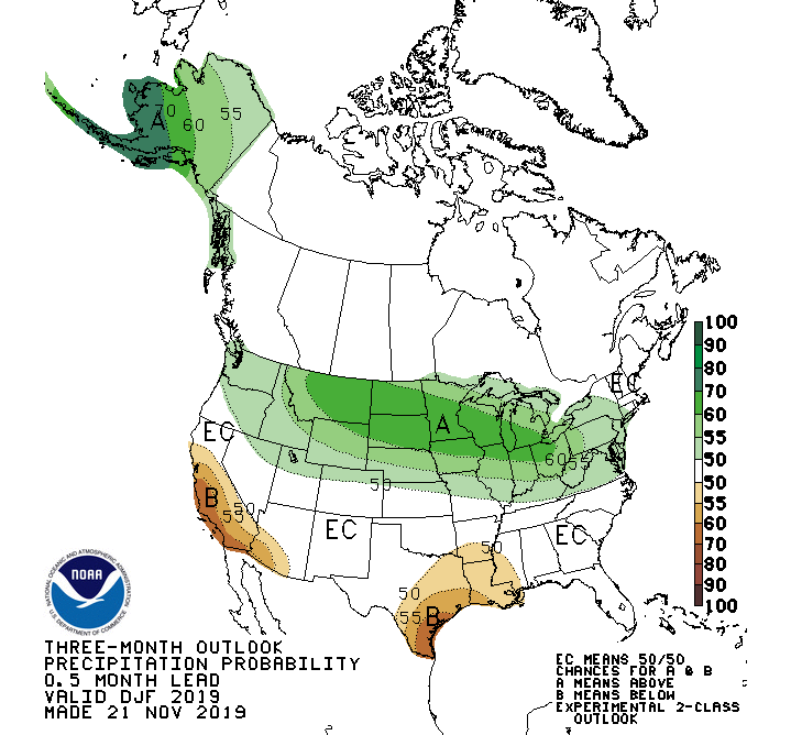
The precipitation forecast from the CPC has now shifted to placing Northwest Wyoming & western Montana under about a 55-percent chance of having above normal precipitation. That’s somewhat more encouraging.
Most of the Pacific Northwest, northern Utah & northern Colorado are riding the 50-percent chance of above normal precip line.
El Nino Situation
The El Niño Southern Oscillation, or ENSO, is one of many indicators long-range forecasters use to decide what the general conditions for the winter season might be across the Northern Hemisphere.
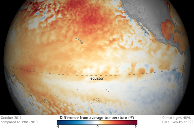
The ENSO actually has three different phases: El Niño, La Niña and Neutral. Sea surface temperatures in the Equatorial Pacific determine the current phase of the ENSO.
An El Niño is occurring when sea surface temperatures are warmer than normal. A La Niña is occurring when temperatures are colder than normal. Neutral ENSO conditions (No Niño) occur when temperatures are near normal, usually when transitioning between the El and La phases.
In general, during an El Niño Winter the northern tier of the United States experiences warmer than normal temperatures and below normal precipitation. At the same time, the southern tier of the United States is usually cooler with above normal precipitation.
During a La Niña Winter the opposite is true, the northern tier of the United States usually experiences a cooler and snowier winter, while the southern tier is usually warmer and drier.
Neutral or No Niño Winters, could go either way. And the ENSO forecast for this winter is for Neutral conditions in the Equatorial Pacific.
ENSO Current status: “Surface temperatures in the east-central tropical Pacific were near to above average in October 2019, but the atmosphere did not react to the warmth. Sub-surface heat that spread across the basin in mid-September was dispersing. Thus, of the three possible outcomes—return of El Niño, La Niña, or neutral—forecasters give neutral the highest odds (70% chance) of continuing through winter.”
What’s it all Mean for JH?
Last winter was a weak El Niño, and pretty much the entire western U.S had a cooler and wetter winter. Jackson Hole was above normal for snowfall, after a record February. That wasn’t supposed to happen.
Historically, from snowfall data for the past 44 winters at the Jackson Hole Mountain Resort, El Niño’s have produced more below normal snowfall winters here than above normal (10 below and 4 above). La Nina’s have produced more above normal snowfall winters than below normal (10 above and 4 below).
Neutral or No Niño’s have also produced more below normal snowfall winters than above normal snowfall winters, but by a smaller margin (9 below and 6 above).
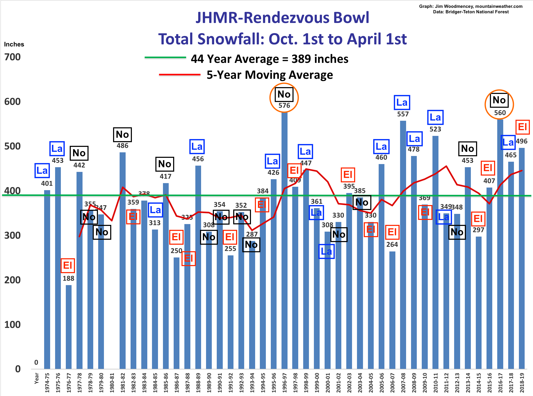
What’s really interesting is, two of those six above normal No Niño winters were the two snowiest winters on record at the Jackson Hole Mountain Resort, the winter of 1996-97 and the winter of 2016-17.
Based on those stats, an optimist would be rooting for another one of those record-breakers during this winter’s No Niño. The pessimist would say chances are less than 50/50 for an above normal snowfall winter.
I already know how many optimists there are in Jackson, just count how many season ski passes have been sold so far.
Post by: Meteorologist Jim Woodmencey