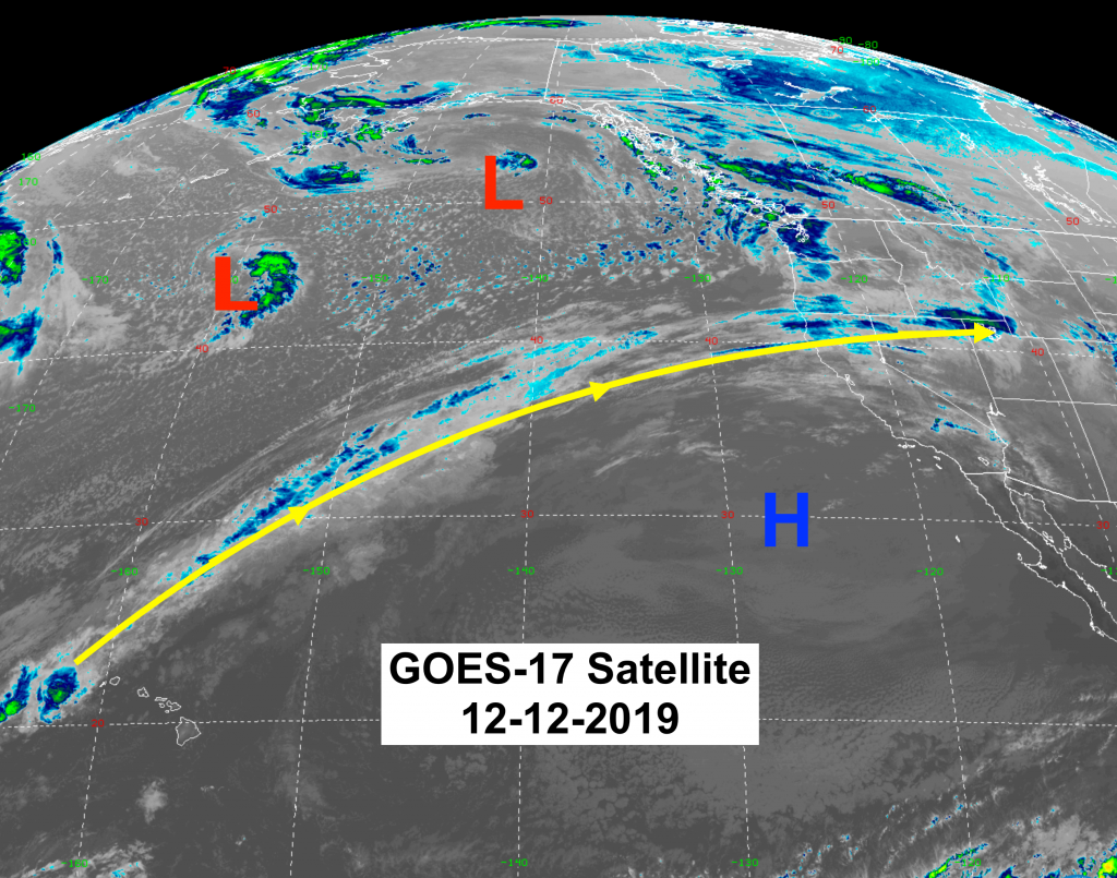
A West to Northwesterly flow aloft over the Western U.S. will yield additional snowfall through this coming weekend. A large area of Low pressure in the Gulf of Alaska, combining with a smaller Low-pressure center currently further out in the Pacific will rotate Pacific moisture across the Cascades, Sierra Nevada, and the northern & Central Rockies.
An area of High pressure also sits off the southern California coast, with a strong jet stream between this High and the Low’s to the north. (Jet Stream is yellow line).
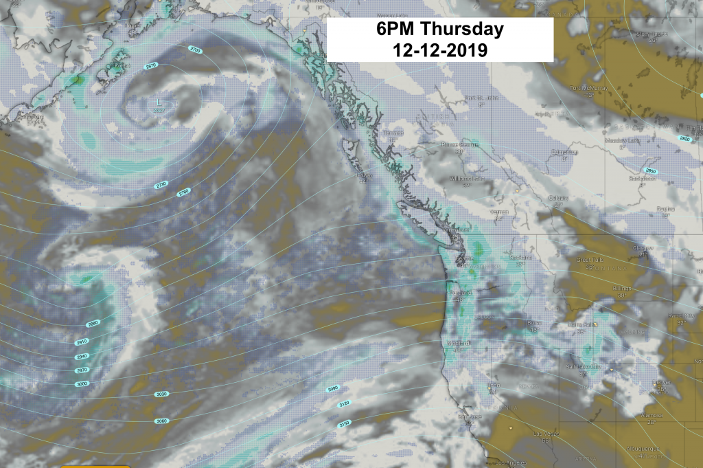
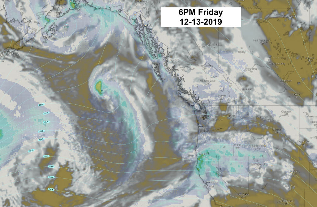
These two Low pressure centers hang around out in the Pacific into the weekend and the jet stream relaxes a bit & winds decrease. Pacific moisture will continue to pulse inland through this weekend. Best periods of snowfall in the mountains appears to be Thursday night and again overnight Friday into Saturday. Best break in precip is during the day Friday.
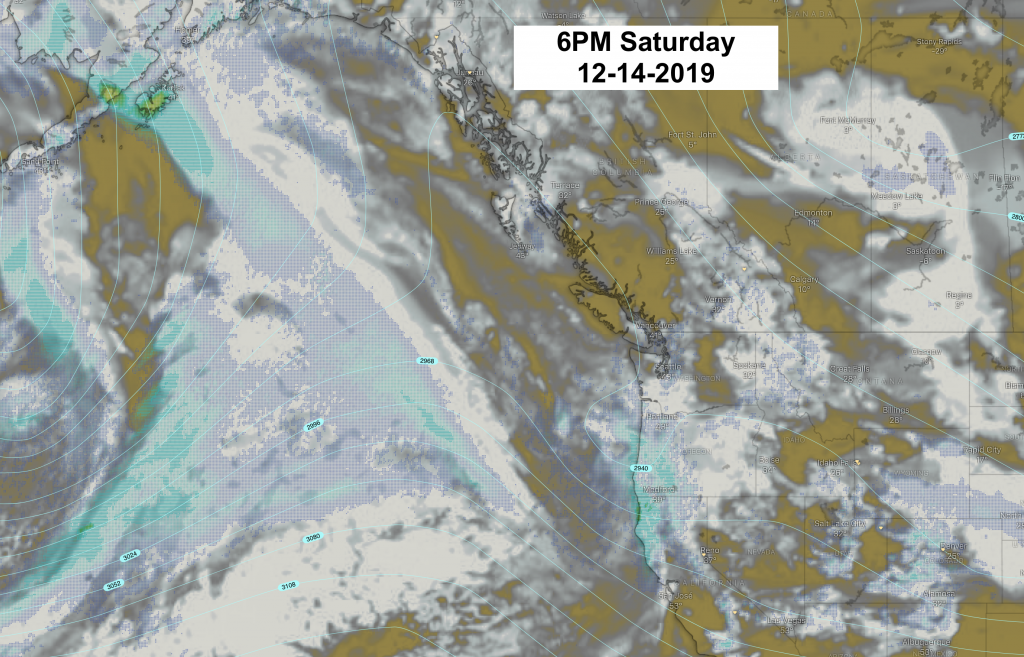
As time goes on , a Ridge of High pressure builds along the West Coast and more Northwesterly flow aloft brings cooler temperatures over the Rockies this weekend. Extending light snow over the northern & central Rockies through Sunday into Monday.
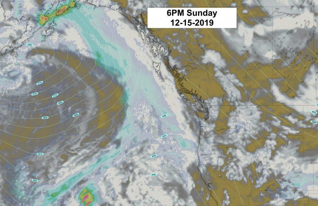
700mb Maps with Forecast Clouds (gray) & Precipitation (blue-green). Maps from Windy.com
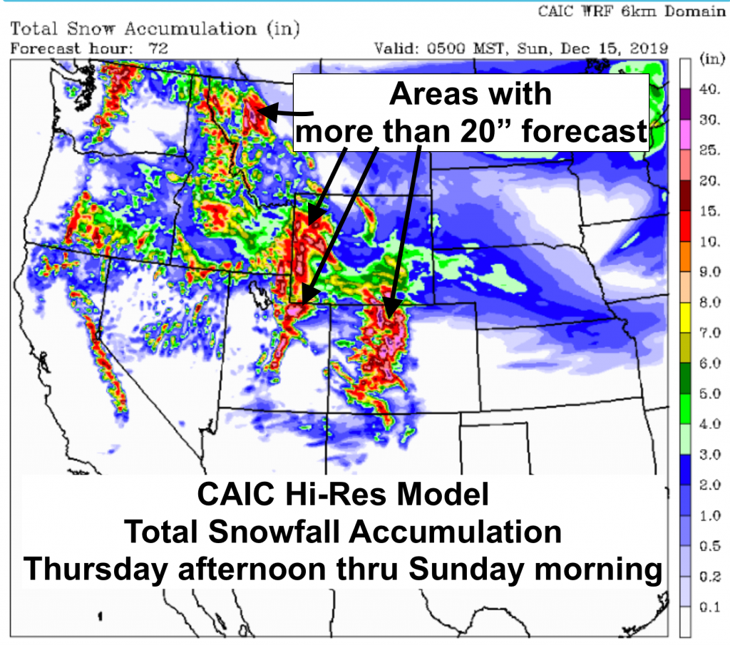
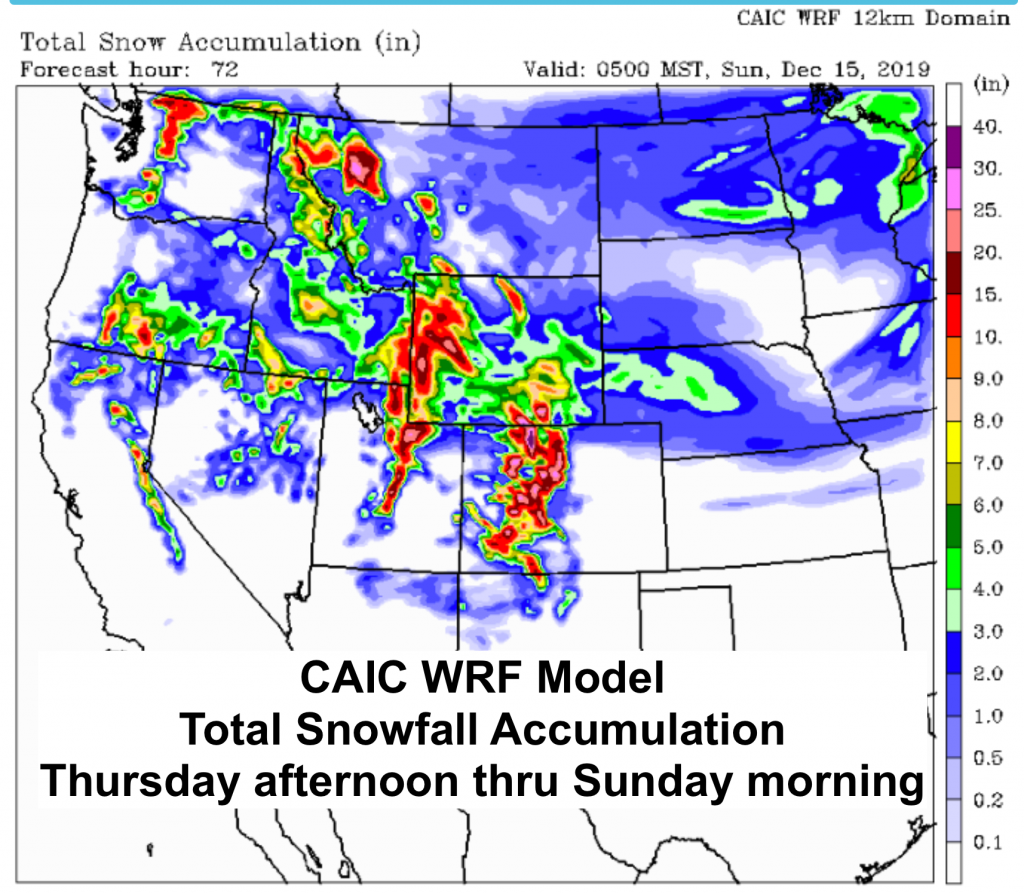
Snowfall Forecasts
Models differ slightly about how much snow will accumulate, but it looks like some mountain areas are favored by this West-NW flow. A few of these models predicted snowfall amounts are shown below.
The first is the high resolution WRF from the Colorado Avalanche Information Center, which shows the greatest amounts in the mountains. Their regular WRF model follows, both examples show snowfall totals from Thursday afternoon to Sunday morning.
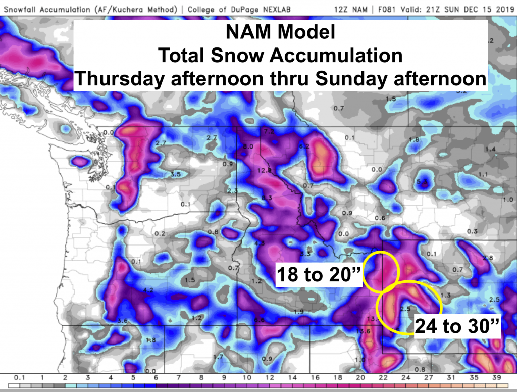
The NAM (North American Model) below with total snow accumulations from Thursday afternoon through Sunday afternoon.
Post by MountainWeather meteorologist Jim Woodmencey