This Saturday is the Winter Solstice and the official start to the winter season, according the calendar at least. Next week is Christmas and then it’s a whole New Year!
To help you plan you your travels, or your ski destination, or to just to get a sense of how white your Christmas is going to be this year, I have compiled the best short and longer-term snowfall forecasts for you to consult. Looks like some places do better than others, by a large measure.
The Short Story
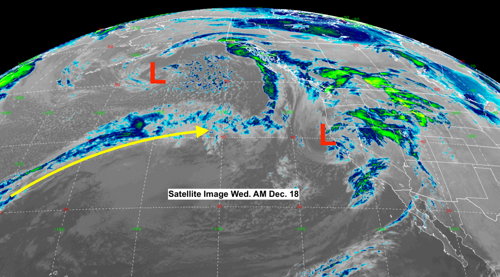
Current weather situation shows Low-pressure systems in the Pacific that weaken and/or split as they move inland this week and Christmas week. Jet stream not continuous or too strong coming out of the Pacific right now.
Solstice Snowfall Forecasts
From today, Wednesday Dec. 18, into Saturday Dec. 21, here are two short-term forecasts that tell a similar tale for new snow accumulation:
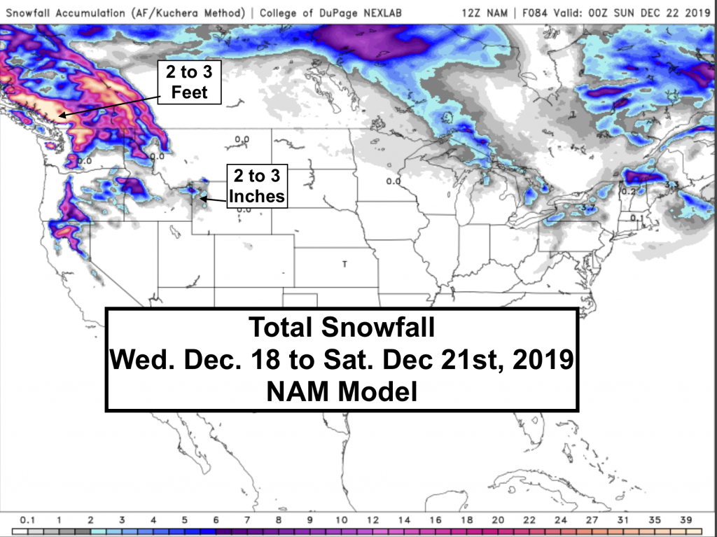
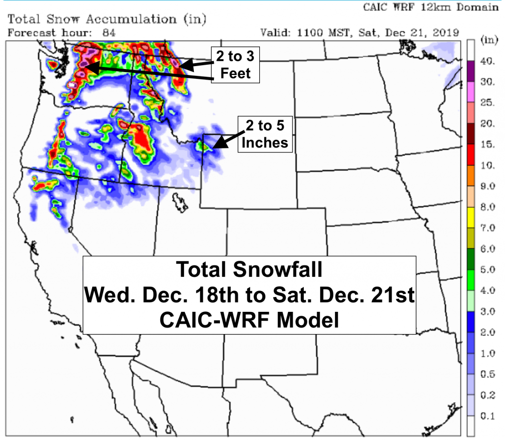
Snowfall Through Christmas Week
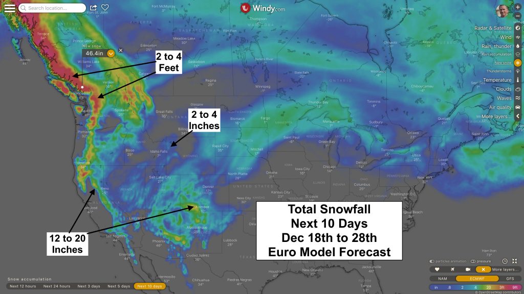
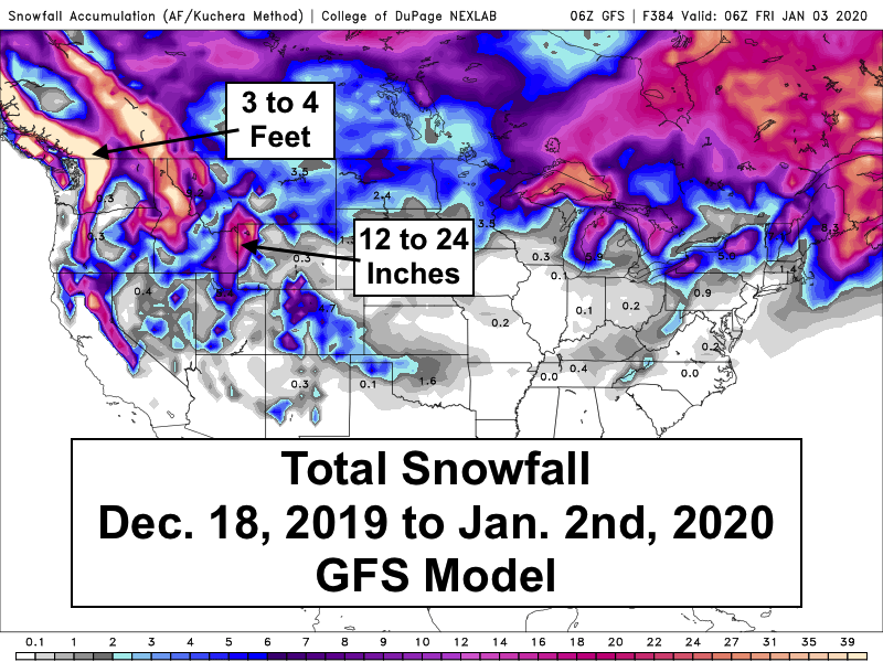
Smaller weather disturbances follow after Christmas and into New Year’s Day. Best bet for big snowfall accumulations this week and next are the Washington Cascades (Mt. Baker) and Southwestern British Columbia’s mountains (Whistler).
Caution: Differences in snow accumulation between the two models below due to the Euro model going out 10 days and the GFS out 14 days. Biggest difference between models is seen over Northwest Wyoming and the Colorado Rockies, due in part to more snowfall after Dec. 28th.
I’ll update this post again in a few days to see if there is any significant change to the snowfall outlook for the Holidays.
Post by meteorologist Jim Woodmencey