Low-pressure systems have been swinging across the Southwestern U.S. this past week or so, but leaving the northern & central Rockies to catch the fringes of those weather systems. That is about to change, for the start of the New Year.
Current Weather Pattern
This series of 700mb maps (@10,000-ft.) shows the transition of the weather pattern over the next few days, A dry & cold Northerly flow over the northern Rockies today, December 30th, gives way to more of a Westerly flow aloft Tuesday and then a Northwesterly flow New Year’s Day. The blue shows areas of moist air and the orange is dry air.
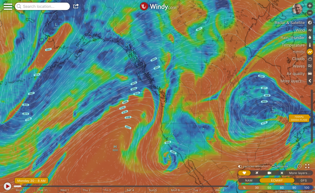
Northerly flow over U.S. Rockies
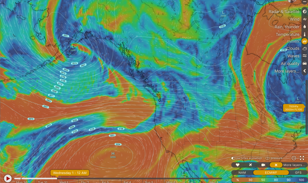
Westerly flow over Northwest & U.S. Rockies
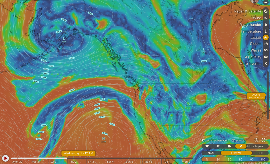
Northwest flow over U.S. Rockies
Short-term Snowfall Forecasts
Here are two short-term snowfall forecasts for Dec. 30th to Jan. 2nd.
The NAM Model (North American Mesoscale) is first. The WRF Model (Weather Research & Forecasting) is next from the CAIC (Colorado Avalanche Info Center).
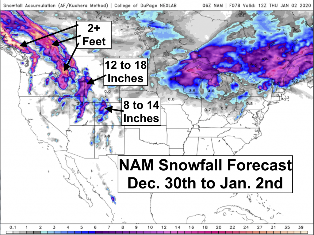
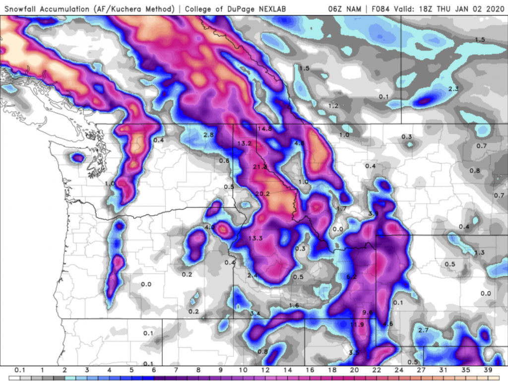
Snow Accumulation Forecast Dec. 30 to Jan 2.
Longer-term Snowfall Forecasts
Next are two model forecast that take us out 10 to 14 days, respectively. The European Model is the weakest for snow accumulation over the next 10 days (Dec. 30 to Jan. 8). The GFS (Global Forecast System) goes pretty big with snow accumulation for the next two weeks in the Rockiess, between Dec. 30 and January 14th, 2020. Good news for the start of the New Year, if it all comes true!
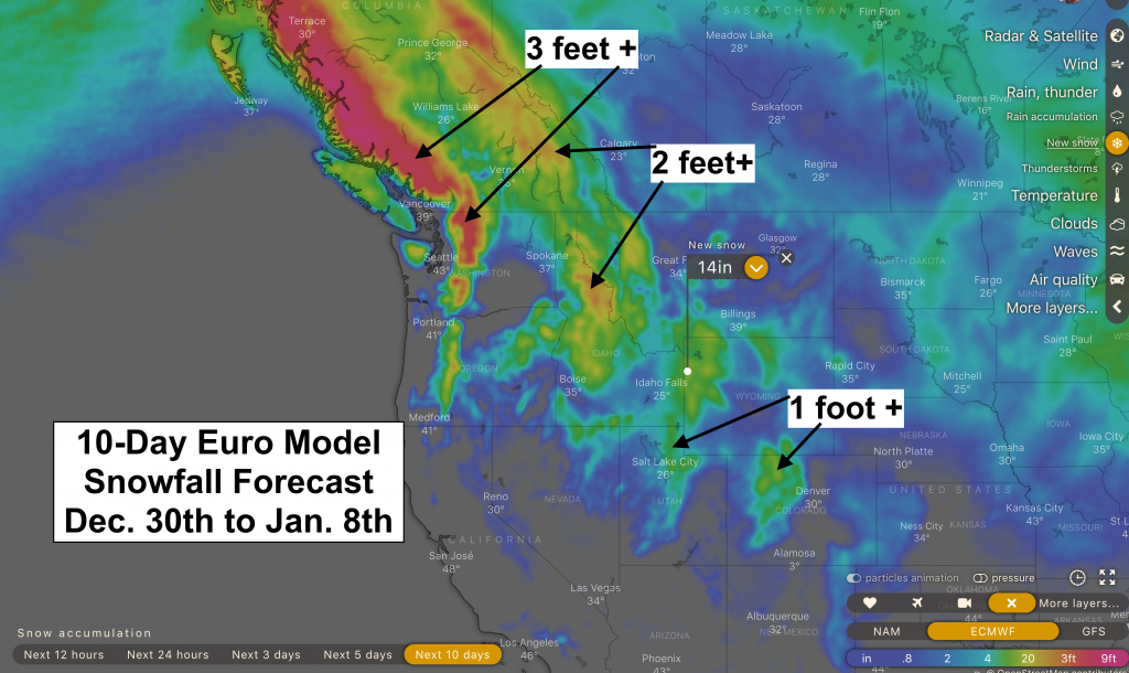
Dec. 30 to Jan. 8
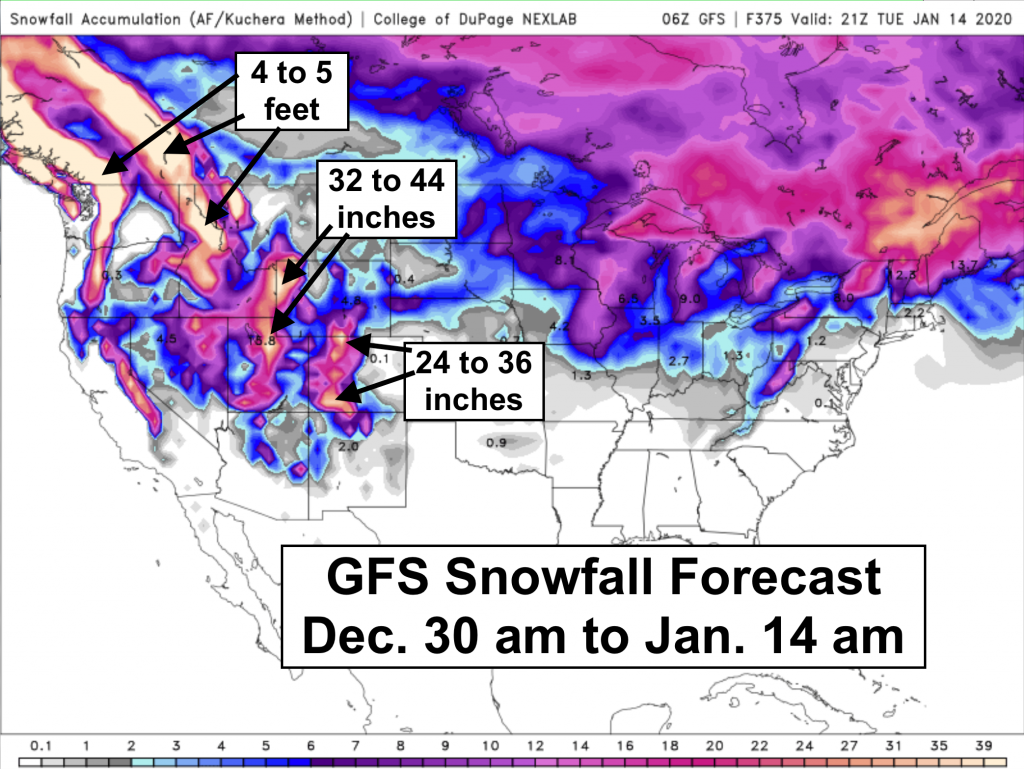
Dec. 30, 2019 through January 14th, 2020
Happy New Year Everyone!
Post by meteorologist Jim Woodmencey