A potent storm system in the Gulf of Alaska will bring snow to the mountains of the Pacific Northwest and Northern Rockies today through Tuesday, lingering into April Fool’s Day.
Map below shows position of Low-pressure Monday, March 30th and forecast position on Tuesday March 31st. Jet stream also pushes inland across Oregon, Idaho and western Wyoming through Tuesday, bringing lots of Pacific moisture in a strong Westerly flow aloft.
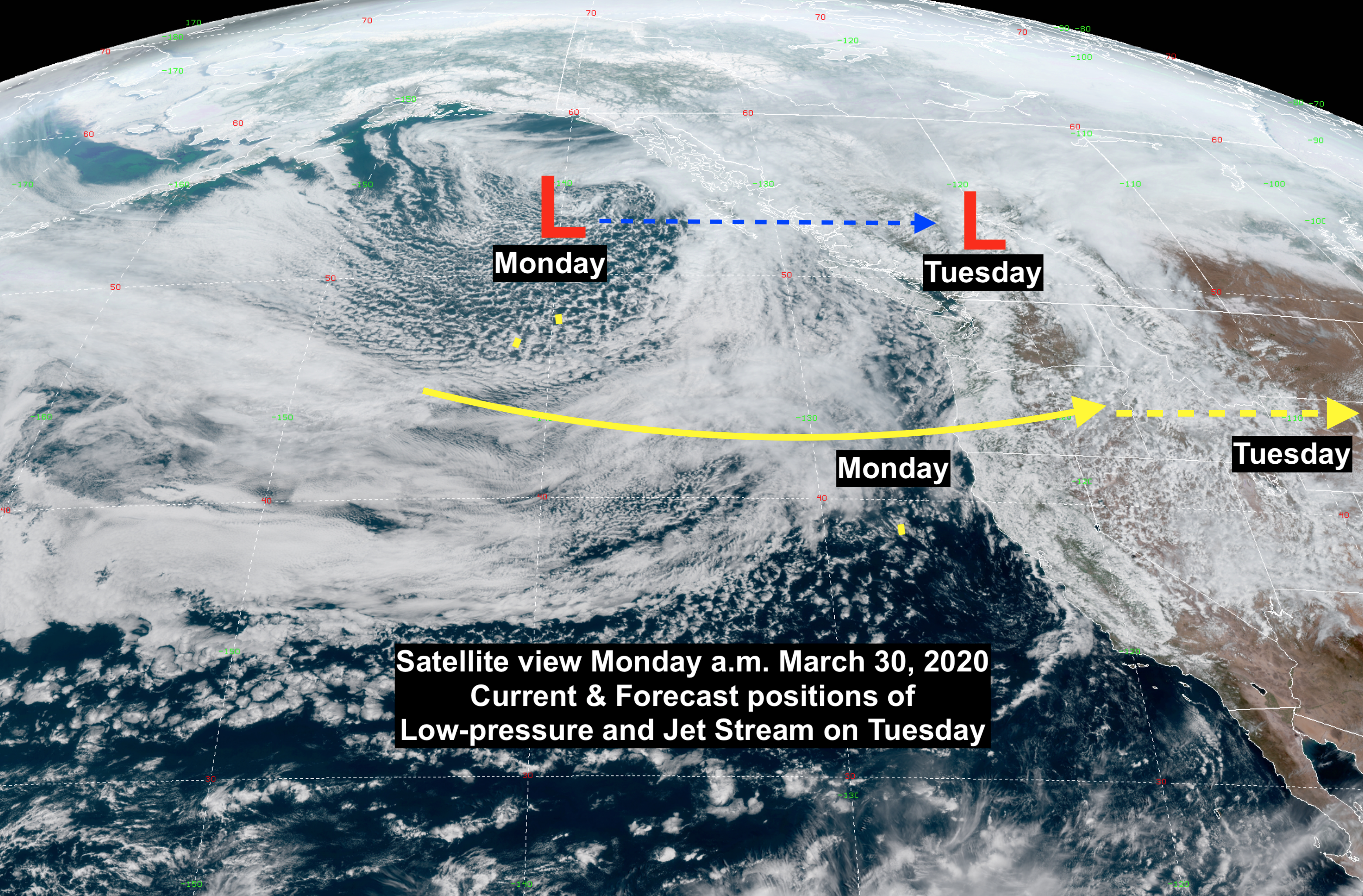
This storm system brings progressively colder air with it, causing snow to progressively lower elevations though Tuesday night. Very unstable atmospheric conditions will also cause some thunderstorms to develop.
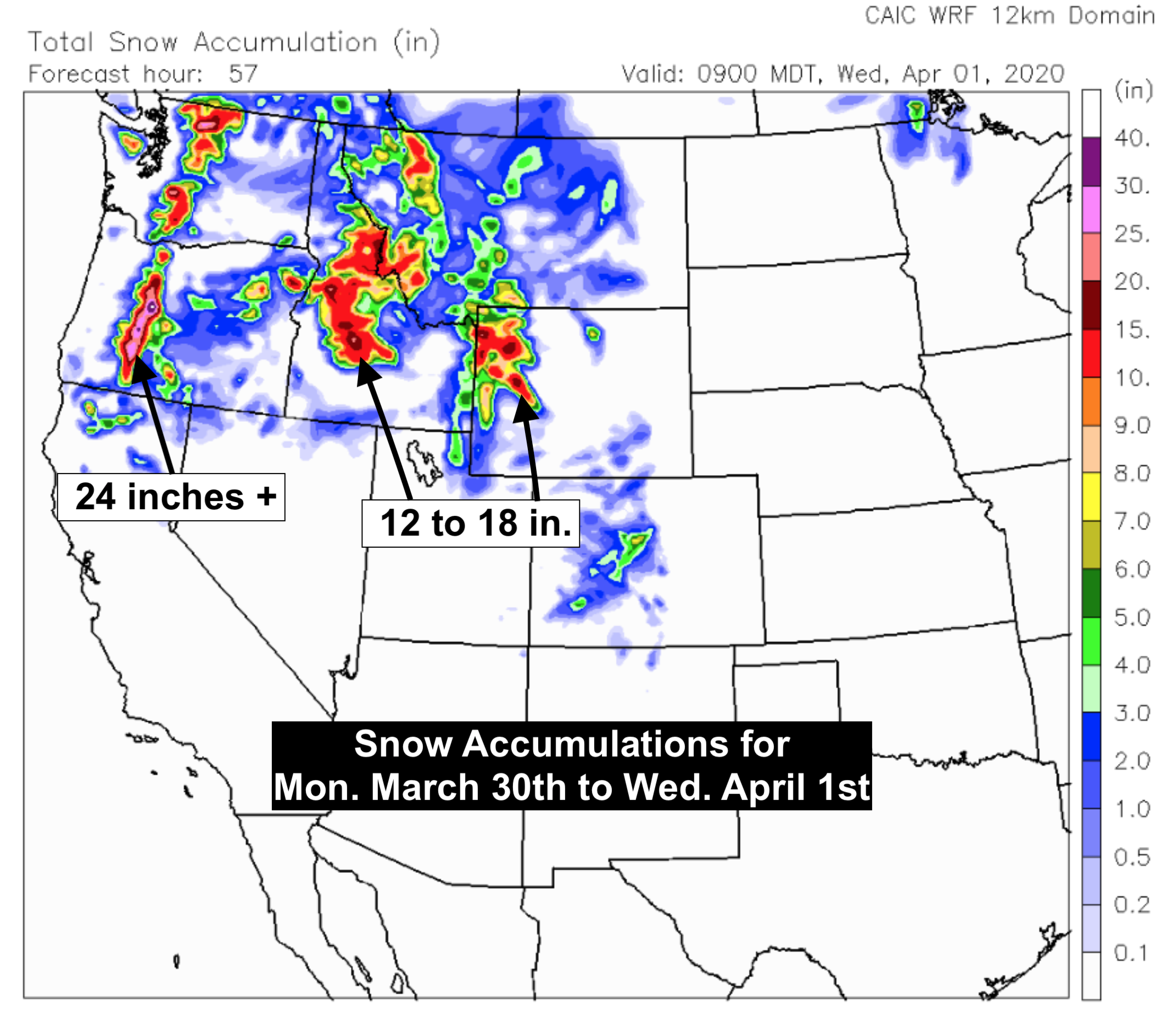
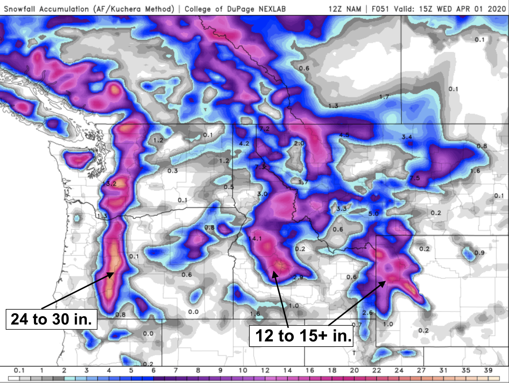
By April Fool’s Day, it looks like snow accumulation in the mountains (especially above @ 9,000-ft.) will be significant: Oregon & Washington Cascades = 24 to 30 inches Central Idaho mountains= 12 to 18 inches. Tetons, Absaroka & Wind River Ranges= 12 to 18 inches also possible.
Snow Forecast Maps
Map below shows one computer model forecast of snow through Wednesday morning, April 1st. (From CAIC WRF model).
Map below shows another computer model snowfall forecast for the same time period. ( From COD NexLab NAM model).
Look like March will go “Out Like a Lion” this year, across the Northwestern United States.
Post by meteorologist Jim Woodmencey